Sira geodata
Sira (Vest-Agder) is a populated place; located in Norway in Europe/Oslo (GMT+2) time zone. With population of 584 people, there are 428 cities with bigger population in this country. Compared to other cities in Norway, 95.6% of cities are located further ↑North; 76.4% of cities are located further →East and 62.2% of cities have lower elevation than Sira. Note1


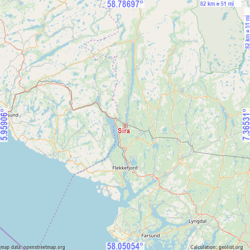
Sira GPS coordinates[2]
58° 25' 14.448" North, 6° 39' 43.848" East
| Map corner | latitude | longitude |
|---|---|---|
| Upper-left | 58.78697°, | 5.95906° |
| Center: | 58.42068°, | 6.66218° |
| Lower-right: | 58.05054°, | 7.36531° |
| Map W x H: | 81.9×81.9 km | = 50.9×50.9mi |
| max Lat: | 71.04137° ⇑95.6% North |
| Sira: | 58.42068° |
| min Lat: | ⇓4.4% South 58.0274° |
| min Long | Sira | max Long |
| 4.71485° | 6.66218° | 31.11066° |
| W 23.6%⇐ | ⇒76.4% E |
Elevation
Elevation of Sira is 79 m = 259 ft, and this is 25.2 m = 83 ft below average elevation for this country.
| Max E: |
897 m = 2943 ft | 37.8% |
| Avg. | 104.2 m = 342 ft | |
| Sira | 79 m = 259 ft | |
Min E: |
1 m = 3 ft | 62.2% |
See also: Norway elevation on elevation.city.
Geographical zone
Sira is located in North temperate zone (between Tropic of Cancer and the Arctic Circle). Distance of this North polar circle is 905.4 km =562.6 mi to North.| Distance of | km | miles | from Sira |
|---|---|---|---|
| North Pole | 3511.3 | 2181.8 | to North |
| Arctic Circle | 905.4 | 562.6 | to North |
| Tropic Cancer | 3889.9 | 2417.1 | to South |
| Equator | 6495.8 | 4036.3 | to South |


Nearby cities:
15 places around Sira: (largest is in red/bold)
• Egersund
38.7 km =24 mi,  275°
275°
• Farsund
37.2 km =23.1 mi,  167°
167°
• Flekkefjord
13.7 km =8.5 mi,  180°
180°
• Hauge i Dalane
23.8 km =14.8 mi,  248°
248°
• Hellvik
46.1 km =28.6 mi, 277°
• Konsmo
43.2 km =26.8 mi,  110°
110°
• Kyrkjebygda
48.7 km =30.3 mi,  63°
63°
• Liknes
21.2 km =13.2 mi,  124°
124°
• Lyngdal
39.5 km =24.5 mi,  142°
142°
• Moi
7.6 km =4.7 mi,  301°
301°
• Tingvatn
32.9 km =20.4 mi,  98°
98°
• Tonstad
27.1 km =16.8 mi,  6°
6°
• Vanse
35.9 km =22.3 mi, 177°
• Vestbygd
35.9 km =22.3 mi,  187°
187°
• Vikeså
41 km =25.5 mi,  306°
306°
Sources, notices
• [Note1] Compared only with cities in Norway existing in our database
• [Src1] Map data: © OpenStreetMap contributors (CC-BY-SA)
• [Src2] Other city data from geonames.org with taken over terms of usage.
• [Src3] Geographical zone / Annual Mean Temperature by Robert A. Rohde @ Wikipedia
