Stanghelle geodata
Stanghelle (Hordaland) is a populated place; located in Norway in Europe/Oslo (GMT+2) time zone. With population of 775 people, there are 360 cities with bigger population in this country. Compared to other cities in Norway, 51.6% of cities are located further ↑North; 86.6% of cities are located further →East and 54.9% of cities have lower elevation than Stanghelle. Note1


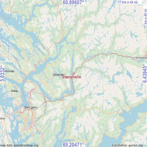
Stanghelle GPS coordinates[2]
60° 33' 8.064" North, 5° 44' 10.752" East
| Map corner | latitude | longitude |
|---|---|---|
| Upper-left | 60.89607°, | 5.0332° |
| Center: | 60.55224°, | 5.73632° |
| Lower-right: | 60.20471°, | 6.43945° |
| Map W x H: | 76.9×76.9 km | = 47.8×47.8mi |
| max Lat: | 71.04137° ⇑51.6% North |
| Stanghelle: | 60.55224° |
| min Lat: | ⇓48.4% South 58.0274° |
| min Long | Stanghelle | max Long |
| 4.71485° | 5.73632° | 31.11066° |
| W 13.4%⇐ | ⇒86.6% E |
Elevation
Elevation of Stanghelle is 60 m = 197 ft, and this is 44.2 m = 145 ft below average elevation for this country.
| Max E: |
897 m = 2943 ft | 45.1% |
| Avg. | 104.2 m = 342 ft | |
| Stanghelle | 60 m = 197 ft | |
Min E: |
1 m = 3 ft | 54.9% |
See also: Norway elevation on elevation.city.
Geographical zone
Stanghelle is located in North temperate zone (between Tropic of Cancer and the Arctic Circle). Distance of this North polar circle is 668.4 km =415.3 mi to North.| Distance of | km | miles | from Stanghelle |
|---|---|---|---|
| North Pole | 3274.3 | 2034.6 | to North |
| Arctic Circle | 668.4 | 415.3 | to North |
| Tropic Cancer | 4126.9 | 2564.3 | to South |
| Equator | 6732.8 | 4183.6 | to South |


Nearby cities:
15 places around Stanghelle: (largest is in red/bold)
• Bergen
28.7 km =17.8 mi,  231°
231°
• Dale
5.9 km =3.7 mi,  49°
49°
• Espeland
24 km =14.9 mi,  218°
218°
• Frekhaug
27.4 km =17 mi,  260°
260°
• Hylkje
21.4 km =13.3 mi, 257°
• Indra Haga
18.4 km =11.4 mi,  174°
174°
• Indre Arna
20.9 km =13 mi, 224°
• Isdalstø
25.5 km =15.8 mi,  270°
270°
• Knarvik
24.8 km =15.4 mi, 268°
• Lonevåg
13.5 km =8.4 mi, 257°
• Mo
29.6 km =18.4 mi,  7°
7°
• Norheimsund
30.2 km =18.8 mi,  131°
131°
• Tysse
19.9 km =12.4 mi,  176°
176°
• Vaksdal
8.4 km =5.2 mi, 178°
• Ytre Arna
19.4 km =12.1 mi,  238°
238°
Sources, notices
• [Note1] Compared only with cities in Norway existing in our database
• [Src1] Map data: © OpenStreetMap contributors (CC-BY-SA)
• [Src2] Other city data from geonames.org with taken over terms of usage.
• [Src3] Geographical zone / Annual Mean Temperature by Robert A. Rohde @ Wikipedia
