Malm geodata
Malm (Trøndelag) is a seat of a second-order administrative division; located in Norway in Europe/Oslo (GMT+2) time zone. With population of 1,230 people, there are 265 cities with bigger population in this country. Compared to other cities in Norway, 80.1% of cities are located further ↓South; 72.8% of cities are located further ←West and 54.9% of cities have lower elevation than Malm. Note1


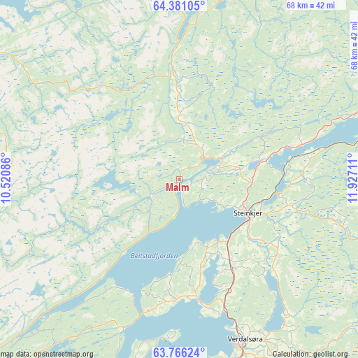
Malm GPS coordinates[2]
64° 4' 31.224" North, 11° 13' 26.328" East
| Map corner | latitude | longitude |
|---|---|---|
| Upper-left | 64.38105°, | 10.52086° |
| Center: | 64.07534°, | 11.22398° |
| Lower-right: | 63.76624°, | 11.92711° |
| Map W x H: | 68.4×68.4 km | = 42.5×42.5mi |
| max Lat: | 71.04137° ⇑19.9% North |
| Malm: | 64.07534° |
| min Lat: | ⇓80.1% South 58.0274° |
| min Long | Malm | max Long |
| 4.71485° | 11.22398° | 31.11066° |
| W 72.8%⇐ | ⇒27.2% E |
Elevation
Elevation of Malm is 60 m = 197 ft, and this is 44.2 m = 145 ft below average elevation for this country.
| Max E: |
897 m = 2943 ft | 45.1% |
| Avg. | 104.2 m = 342 ft | |
| Malm | 60 m = 197 ft | |
Min E: |
1 m = 3 ft | 54.9% |
See also: Norway elevation on elevation.city.
Geographical zone
Malm is located in North temperate zone (between Tropic of Cancer and the Arctic Circle). Distance of this North polar circle is 276.7 km =171.9 mi to North.| Distance of | km | miles | from Malm |
|---|---|---|---|
| North Pole | 2882.6 | 1791.2 | to North |
| Arctic Circle | 276.7 | 171.9 | to North |
| Tropic Cancer | 4518.6 | 2807.7 | to South |
| Equator | 7124.5 | 4427 | to South |


Nearby cities:
15 places around Malm: (largest is in red/bold)
• Bangsund
36.2 km =22.5 mi,  13°
13°
• Lauvsnes
49.9 km =31 mi,  341°
341°
• Levanger
36.8 km =22.9 mi,  174°
174°
• Namdalseid
16.3 km =10.1 mi,  359°
359°
• Namsos
45.4 km =28.2 mi,  16°
16°
• Roan
49.5 km =30.8 mi,  282°
282°
• Skage
50.6 km =31.4 mi,  30°
30°
• Skogn
41.3 km =25.7 mi,  182°
182°
• Sparbu
20.1 km =12.5 mi,  149°
149°
• Steinkjer
14.8 km =9.2 mi,  116°
116°
• Steinsdalen
42.5 km =26.4 mi,  305°
305°
• Straumen
22.9 km =14.2 mi, 171°
• Verdal
33.8 km =21 mi,  158°
158°
• Å i Åfjord
50.3 km =31.3 mi,  255°
255°
• Årnes
50.2 km =31.2 mi, 255°
Sources, notices
• [Note1] Compared only with cities in Norway existing in our database
• [Src1] Map data: © OpenStreetMap contributors (CC-BY-SA)
• [Src2] Other city data from geonames.org with taken over terms of usage.
• [Src3] Geographical zone / Annual Mean Temperature by Robert A. Rohde @ Wikipedia
