Hattfjelldal geodata
Hattfjelldal (Nordland) is a seat of a second-order administrative division; located in Norway in Europe/Oslo (GMT+2) time zone. In our database, there are 488 cities with bigger population. Compared to other cities in Norway, 83.7% of cities are located further ↓South; 87.5% of cities are located further ←West and 86.4% of cities have lower elevation than Hattfjelldal. Note1


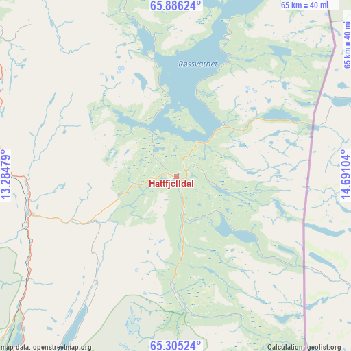
Hattfjelldal GPS coordinates[2]
65° 35' 50.496" North, 13° 59' 16.476" East
| Map corner | latitude | longitude |
|---|---|---|
| Upper-left | 65.88624°, | 13.28479° |
| Center: | 65.59736°, | 13.98791° |
| Lower-right: | 65.30524°, | 14.69104° |
| Map W x H: | 64.6×64.6 km | = 40.1×40.1mi |
| max Lat: | 71.04137° ⇑16.3% North |
| Hattfjelldal: | 65.59736° |
| min Lat: | ⇓83.7% South 58.0274° |
| min Long | Hattfjelldal | max Long |
| 4.71485° | 13.98791° | 31.11066° |
| W 87.5%⇐ | ⇒12.5% E |
Elevation
Elevation of Hattfjelldal is 220 m = 722 ft, and this is 115.8 m = 380 ft above average elevation for this country.
| Max E: |
897 m = 2943 ft | 13.6% |
| Hattfjelldal | 220 m 722 ft | |
| Avg. | 104.2 m = 342 ft | |
Min E: |
1 m = 3 ft | 86.4% |
See also: Norway elevation on elevation.city.
Geographical zone
Hattfjelldal is located in North temperate zone (between Tropic of Cancer and the Arctic Circle). Distance of this North polar circle is 107.4 km =66.7 mi to North.| Distance of | km | miles | from Hattfjelldal |
|---|---|---|---|
| North Pole | 2713.3 | 1686 | to North |
| Arctic Circle | 107.4 | 66.7 | to North |
| Tropic Cancer | 4687.8 | 2912.9 | to South |
| Equator | 7293.7 | 4532.1 | to South |


Nearby cities:
15 places around Hattfjelldal: (largest is in red/bold)
• Brønnøysund
82.9 km =51.5 mi,  260°
260°
• Hauknes
76.4 km =47.5 mi,  2°
2°
• Hemnesberget
71.8 km =44.6 mi,  346°
346°
• Korgen
53.8 km =33.4 mi, 351°
• Leland
70.4 km =43.7 mi,  317°
317°
• Mo i Rana
79.9 km =49.6 mi,  5°
5°
• Mosjøen
45.1 km =28 mi,  306°
306°
• Namsskogan
83.7 km =52 mi,  207°
207°
• Nesna
80 km =49.7 mi,  326°
326°
• Røyrvik
81.8 km =50.8 mi,  194°
194°
• Sandnessjøen
77.7 km =48.3 mi, 307°
• Silvalen
88.6 km =55.1 mi,  298°
298°
• Solfjellsjøen
89.5 km =55.6 mi, 310°
• Trofors
27.7 km =17.2 mi, 255°
• Vevelstad
72 km =44.7 mi,  278°
278°
Sources, notices
• [Note1] Compared only with cities in Norway existing in our database
• [Src1] Map data: © OpenStreetMap contributors (CC-BY-SA)
• [Src2] Other city data from geonames.org with taken over terms of usage.
• [Src3] Geographical zone / Annual Mean Temperature by Robert A. Rohde @ Wikipedia
