Mjøndalen geodata
Mjøndalen (Buskerud) is a seat of a second-order administrative division; located in Norway in Europe/Oslo (GMT+2) time zone. In our database, there are 488 cities with bigger population. Compared to other cities in Norway, 71.7% of cities are located further ↑North; 51.1% of cities are located further →East and 86.1% of cities have higher elevation than Mjøndalen. Note1


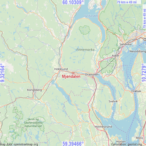
Mjøndalen GPS coordinates[2]
59° 45' 2.7" North, 10° 1' 29.172" East
| Map corner | latitude | longitude |
|---|---|---|
| Upper-left | 60.10309°, | 9.32164° |
| Center: | 59.75075°, | 10.02477° |
| Lower-right: | 59.39466°, | 10.7279° |
| Map W x H: | 78.8×78.8 km | = 49×49mi |
| max Lat: | 71.04137° ⇑71.7% North |
| Mjøndalen: | 59.75075° |
| min Lat: | ⇓28.3% South 58.0274° |
| min Long | Mjøndalen | max Long |
| 4.71485° | 10.02477° | 31.11066° |
| W 48.9%⇐ | ⇒51.1% E |
Elevation
Elevation of Mjøndalen is 7 m = 23 ft, and this is 97.2 m = 319 ft below average elevation for this country.
| Max E: |
897 m = 2943 ft | 86.1% |
| Avg. | 104.2 m = 342 ft | |
| Mjøndalen | 7 m = 23 ft | |
Min E: |
1 m = 3 ft | 13.9% |
See also: Norway elevation on elevation.city.
Geographical zone
Mjøndalen is located in North temperate zone (between Tropic of Cancer and the Arctic Circle). Distance of this North polar circle is 757.5 km =470.7 mi to North.| Distance of | km | miles | from Mjøndalen |
|---|---|---|---|
| North Pole | 3363.4 | 2089.9 | to North |
| Arctic Circle | 757.5 | 470.7 | to North |
| Tropic Cancer | 4037.7 | 2508.9 | to South |
| Equator | 6643.7 | 4128.2 | to South |


Nearby cities:
15 places around Mjøndalen: (largest is in red/bold)
• Asker
24.8 km =15.4 mi,  68°
68°
• Blakstad
25.8 km =16 mi, 72°
• Drammen
10.1 km =6.3 mi,  94°
94°
• Hokksund
6.8 km =4.2 mi,  289°
289°
• Kongsberg
22.9 km =14.2 mi,  246°
246°
• Lierbyen
12.9 km =8 mi, 72°
• Røyken
20.4 km =12.7 mi, 91°
• Sande
20.9 km =13 mi,  150°
150°
• Selvik
24.4 km =15.2 mi, 147°
• Skoger
13.5 km =8.4 mi,  108°
108°
• Slemmestad
26.6 km =16.5 mi,  82°
82°
• Svelvik
26.4 km =16.4 mi,  125°
125°
• Sylling
21.7 km =13.5 mi,  43°
43°
• Tranby
14.7 km =9.1 mi,  64°
64°
• Vikersund
24.3 km =15.1 mi,  355°
355°
Sources, notices
• [Note1] Compared only with cities in Norway existing in our database
• [Src1] Map data: © OpenStreetMap contributors (CC-BY-SA)
• [Src2] Other city data from geonames.org with taken over terms of usage.
• [Src3] Geographical zone / Annual Mean Temperature by Robert A. Rohde @ Wikipedia
