Elverum geodata
Elverum (Hedmark) is a seat of a second-order administrative division; located in Norway in Europe/Oslo (GMT+2) time zone. With population of 12,490 people, there are 38 cities with bigger population in this country. Compared to other cities in Norway, 54.4% of cities are located further ↓South; 78.5% of cities are located further ←West and 83.2% of cities have lower elevation than Elverum. Note1


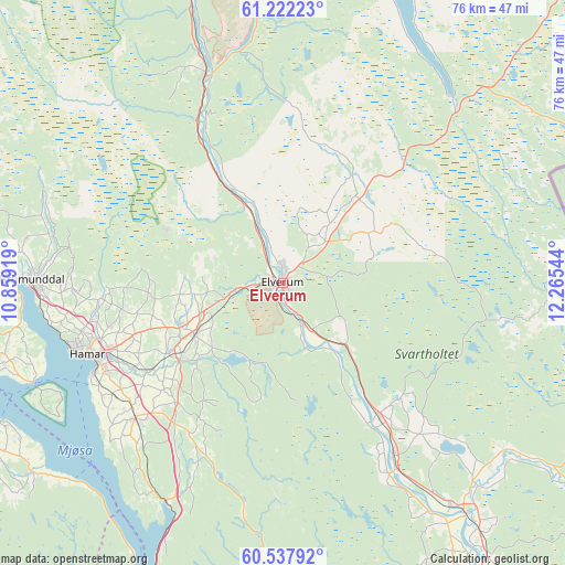
Elverum GPS coordinates[2]
60° 52' 54.876" North, 11° 33' 44.316" East
| Map corner | latitude | longitude |
|---|---|---|
| Upper-left | 61.22223°, | 10.85919° |
| Center: | 60.88191°, | 11.56231° |
| Lower-right: | 60.53792°, | 12.26544° |
| Map W x H: | 76.1×76.1 km | = 47.3×47.3mi |
| max Lat: | 71.04137° ⇑45.6% North |
| Elverum: | 60.88191° |
| min Lat: | ⇓54.4% South 58.0274° |
| min Long | Elverum | max Long |
| 4.71485° | 11.56231° | 31.11066° |
| W 78.5%⇐ | ⇒21.5% E |
Elevation
Elevation of Elverum is 197 m = 646 ft, and this is 92.8 m = 304 ft above average elevation for this country.
| Max E: |
897 m = 2943 ft | 16.8% |
| Elverum | 197 m 646 ft | |
| Avg. | 104.2 m = 342 ft | |
Min E: |
1 m = 3 ft | 83.2% |
See also: Norway elevation on elevation.city.
Geographical zone
Elverum is located in North temperate zone (between Tropic of Cancer and the Arctic Circle). Distance of this North polar circle is 631.7 km =392.5 mi to North.| Distance of | km | miles | from Elverum |
|---|---|---|---|
| North Pole | 3237.6 | 2011.8 | to North |
| Arctic Circle | 631.7 | 392.5 | to North |
| Tropic Cancer | 4163.5 | 2587.1 | to South |
| Equator | 6769.4 | 4206.3 | to South |


Nearby cities:
15 places around Elverum: (largest is in red/bold)
• Brumunddal
33.7 km =20.9 mi,  269°
269°
• Flisa
38.6 km =24 mi,  140°
140°
• Gjøvik
48.1 km =29.9 mi,  258°
258°
• Hamar
28.5 km =17.7 mi,  250°
250°
• Hof
44.3 km =27.5 mi,  145°
145°
• Ilseng
21.7 km =13.5 mi,  236°
236°
• Kolbu
51.3 km =31.9 mi, 239°
• Lena
46.8 km =29.1 mi, 240°
• Løten
13.8 km =8.6 mi, 239°
• Moelv
47 km =29.2 mi,  276°
276°
• Rena
29.7 km =18.5 mi,  339°
339°
• Skreia
42.5 km =26.4 mi,  233°
233°
• Stange
27 km =16.8 mi, 227°
• Våler
27.7 km =17.2 mi, 147°
• Ådalsbruk
16.7 km =10.4 mi, 235°
Sources, notices
• [Note1] Compared only with cities in Norway existing in our database
• [Src1] Map data: © OpenStreetMap contributors (CC-BY-SA)
• [Src2] Other city data from geonames.org with taken over terms of usage.
• [Src3] Geographical zone / Annual Mean Temperature by Robert A. Rohde @ Wikipedia
