Våler geodata
Våler (Hedmark) is a seat of a second-order administrative division; located in Norway in Europe/Oslo (GMT+2) time zone. With population of 1,188 people, there are 270 cities with bigger population in this country. Compared to other cities in Norway, 50.8% of cities are located further ↓South; 80.2% of cities are located further ←West and 81.2% of cities have lower elevation than Våler. Note1


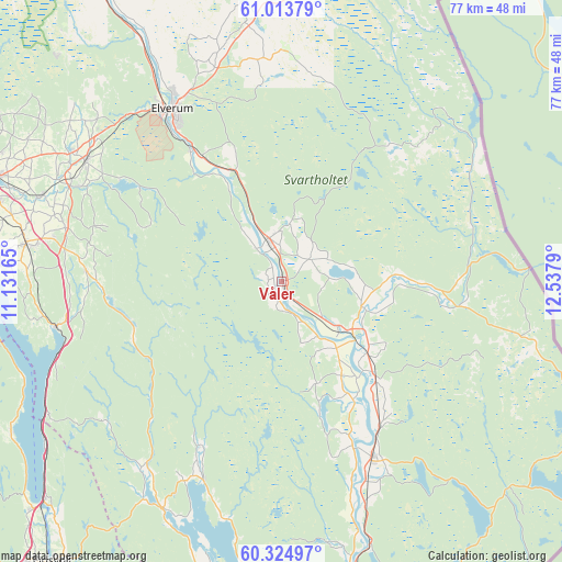
Våler GPS coordinates[2]
60° 40' 16.392" North, 11° 50' 5.172" East
| Map corner | latitude | longitude |
|---|---|---|
| Upper-left | 61.01379°, | 11.13165° |
| Center: | 60.67122°, | 11.83477° |
| Lower-right: | 60.32497°, | 12.5379° |
| Map W x H: | 76.6×76.6 km | = 47.6×47.6mi |
| max Lat: | 71.04137° ⇑49.2% North |
| Våler: | 60.67122° |
| min Lat: | ⇓50.8% South 58.0274° |
| min Long | Våler | max Long |
| 4.71485° | 11.83477° | 31.11066° |
| W 80.2%⇐ | ⇒19.8% E |
Elevation
Elevation of Våler is 180 m = 591 ft, and this is 75.8 m = 249 ft above average elevation for this country.
| Max E: |
897 m = 2943 ft | 18.8% |
| Våler | 180 m 591 ft | |
| Avg. | 104.2 m = 342 ft | |
Min E: |
1 m = 3 ft | 81.2% |
See also: Norway elevation on elevation.city.
Geographical zone
Våler is located in North temperate zone (between Tropic of Cancer and the Arctic Circle). Distance of this North polar circle is 655.2 km =407.1 mi to North.| Distance of | km | miles | from Våler |
|---|---|---|---|
| North Pole | 3261.1 | 2026.4 | to North |
| Arctic Circle | 655.2 | 407.1 | to North |
| Tropic Cancer | 4140.1 | 2572.5 | to South |
| Equator | 6746 | 4191.8 | to South |


Nearby cities:
15 places around Våler: (largest is in red/bold)
• Eidsvoll
49.1 km =30.5 mi,  219°
219°
• Elverum
27.7 km =17.2 mi,  327°
327°
• Flisa
11.6 km =7.2 mi,  123°
123°
• Hamar
43.9 km =27.3 mi,  288°
288°
• Hof
16.7 km =10.4 mi,  142°
142°
• Hurdal
49.5 km =30.8 mi,  237°
237°
• Ilseng
35 km =21.7 mi, 289°
• Kirkenær
26.7 km =16.6 mi,  152°
152°
• Løten
31.4 km =19.5 mi,  301°
301°
• Roverud
48 km =29.8 mi,  165°
165°
• Sand
35 km =21.7 mi,  207°
207°
• Skarnes
47.1 km =29.3 mi,  190°
190°
• Skreia
49 km =30.4 mi,  267°
267°
• Stange
35.2 km =21.9 mi,  278°
278°
• Ådalsbruk
31.8 km =19.8 mi, 295°
Sources, notices
• [Note1] Compared only with cities in Norway existing in our database
• [Src1] Map data: © OpenStreetMap contributors (CC-BY-SA)
• [Src2] Other city data from geonames.org with taken over terms of usage.
• [Src3] Geographical zone / Annual Mean Temperature by Robert A. Rohde @ Wikipedia
