Stange geodata
Stange (Hedmark) is a seat of a second-order administrative division; located in Norway in Europe/Oslo (GMT+2) time zone. With population of 2,416 people, there are 161 cities with bigger population in this country. Compared to other cities in Norway, 51.6% of cities are located further ↓South; 71.8% of cities are located further ←West and 86.4% of cities have lower elevation than Stange. Note1


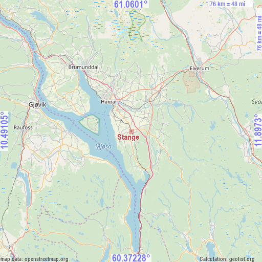
Stange GPS coordinates[2]
60° 43' 4.908" North, 11° 11' 39.012" East
| Map corner | latitude | longitude |
|---|---|---|
| Upper-left | 61.0601°, | 10.49105° |
| Center: | 60.71803°, | 11.19417° |
| Lower-right: | 60.37228°, | 11.8973° |
| Map W x H: | 76.5×76.5 km | = 47.5×47.5mi |
| max Lat: | 71.04137° ⇑48.4% North |
| Stange: | 60.71803° |
| min Lat: | ⇓51.6% South 58.0274° |
| min Long | Stange | max Long |
| 4.71485° | 11.19417° | 31.11066° |
| W 71.8%⇐ | ⇒28.2% E |
Elevation
Elevation of Stange is 220 m = 722 ft, and this is 115.8 m = 380 ft above average elevation for this country.
| Max E: |
897 m = 2943 ft | 13.6% |
| Stange | 220 m 722 ft | |
| Avg. | 104.2 m = 342 ft | |
Min E: |
1 m = 3 ft | 86.4% |
See also: Norway elevation on elevation.city.
Geographical zone
Stange is located in North temperate zone (between Tropic of Cancer and the Arctic Circle). Distance of this North polar circle is 650 km =403.9 mi to North.| Distance of | km | miles | from Stange |
|---|---|---|---|
| North Pole | 3255.8 | 2023.1 | to North |
| Arctic Circle | 650 | 403.9 | to North |
| Tropic Cancer | 4145.3 | 2575.8 | to South |
| Equator | 6751.2 | 4195 | to South |


Nearby cities:
15 places around Stange: (largest is in red/bold)
• Brumunddal
22.8 km =14.2 mi,  322°
322°
• Eina
33.9 km =21.1 mi,  252°
252°
• Elverum
27 km =16.8 mi,  47°
47°
• Gjøvik
28.6 km =17.8 mi,  287°
287°
• Hamar
10.9 km =6.8 mi, 321°
• Hurdal
32.2 km =20 mi,  192°
192°
• Ilseng
6.7 km =4.2 mi,  15°
15°
• Kolbu
25.6 km =15.9 mi, 252°
• Lena
21.3 km =13.2 mi,  256°
256°
• Løten
13.8 km =8.6 mi,  35°
35°
• Raufoss
31.6 km =19.6 mi,  271°
271°
• Reinsvoll
31.4 km =19.5 mi, 262°
• Skreia
15.8 km =9.8 mi,  242°
242°
• Våler
35.2 km =21.9 mi,  98°
98°
• Ådalsbruk
10.7 km =6.6 mi, 35°
Sources, notices
• [Note1] Compared only with cities in Norway existing in our database
• [Src1] Map data: © OpenStreetMap contributors (CC-BY-SA)
• [Src2] Other city data from geonames.org with taken over terms of usage.
• [Src3] Geographical zone / Annual Mean Temperature by Robert A. Rohde @ Wikipedia
