Eidfjord geodata
Eidfjord (Hordaland) is a seat of a second-order administrative division; located in Norway in Europe/Oslo (GMT+2) time zone. With population of 569 people, there are 435 cities with bigger population in this country. Compared to other cities in Norway, 52.8% of cities are located further ↑North; 73.1% of cities are located further →East and 62.5% of cities have higher elevation than Eidfjord. Note1


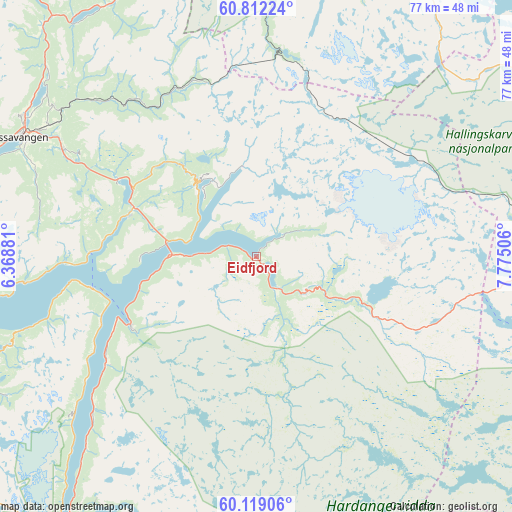
Eidfjord GPS coordinates[2]
60° 28' 3" North, 7° 4' 18.948" East
| Map corner | latitude | longitude |
|---|---|---|
| Upper-left | 60.81224°, | 6.36881° |
| Center: | 60.4675°, | 7.07193° |
| Lower-right: | 60.11906°, | 7.77506° |
| Map W x H: | 77.1×77.1 km | = 47.9×47.9mi |
| max Lat: | 71.04137° ⇑52.8% North |
| Eidfjord: | 60.4675° |
| min Lat: | ⇓47.2% South 58.0274° |
| min Long | Eidfjord | max Long |
| 4.71485° | 7.07193° | 31.11066° |
| W 26.9%⇐ | ⇒73.1% E |
Elevation
Elevation of Eidfjord is 25 m = 82 ft, and this is 79.2 m = 260 ft below average elevation for this country.
| Max E: |
897 m = 2943 ft | 62.5% |
| Avg. | 104.2 m = 342 ft | |
| Eidfjord | 25 m = 82 ft | |
Min E: |
1 m = 3 ft | 37.5% |
See also: Norway elevation on elevation.city.
Geographical zone
Eidfjord is located in North temperate zone (between Tropic of Cancer and the Arctic Circle). Distance of this North polar circle is 677.8 km =421.2 mi to North.| Distance of | km | miles | from Eidfjord |
|---|---|---|---|
| North Pole | 3283.7 | 2040.4 | to North |
| Arctic Circle | 677.8 | 421.2 | to North |
| Tropic Cancer | 4117.4 | 2558.4 | to South |
| Equator | 6723.4 | 4177.7 | to South |


Nearby cities:
15 places around Eidfjord: (largest is in red/bold)
• Aurlandsvangen
49.1 km =30.5 mi,  7°
7°
• Dale
69.8 km =43.4 mi,  280°
280°
• Geilo
62.5 km =38.8 mi,  83°
83°
• Granvin
20.3 km =12.6 mi,  288°
288°
• Hol
68.8 km =42.8 mi, 76°
• Indre Ålvik
35.3 km =21.9 mi,  263°
263°
• Jondal
49.9 km =31 mi,  244°
244°
• Kinsarvik
21.9 km =13.6 mi, 242°
• Lofthus
27.1 km =16.8 mi, 236°
• Norheimsund
52 km =32.3 mi, 258°
• Odda
53 km =32.9 mi,  213°
213°
• Tyssedal
48.2 km =30 mi,  215°
215°
• Ulvik
14 km =8.7 mi,  322°
322°
• Voss
40.2 km =25 mi,  296°
296°
• Øystese
49.1 km =30.5 mi, 259°
Sources, notices
• [Note1] Compared only with cities in Norway existing in our database
• [Src1] Map data: © OpenStreetMap contributors (CC-BY-SA)
• [Src2] Other city data from geonames.org with taken over terms of usage.
• [Src3] Geographical zone / Annual Mean Temperature by Robert A. Rohde @ Wikipedia
