Husøya geodata
Husøya (Nordland) is a seat of a second-order administrative division; located in Norway in Europe/Oslo (GMT+2) time zone. In our database, there are 488 cities with bigger population. Compared to other cities in Norway, 86.1% of cities are located further ↓South; 81.8% of cities are located further ←West and 93% of cities have higher elevation than Husøya. Note1


Husøya GPS coordinates[2]
66° 30' 5.724" North, 12° 5' 47.22" East
| Map corner | latitude | longitude |
|---|---|---|
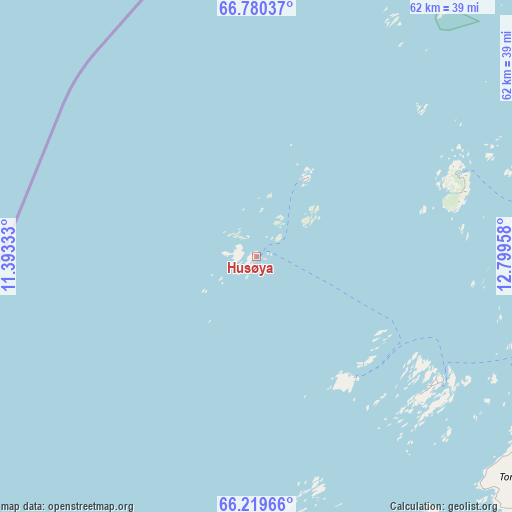
| Upper-left | 66.78037°, | 11.39333° |
| Center: | 66.50159°, | 12.09645° |
| Lower-right: | 66.21966°, | 12.79958° |
| Map W x H: | 62.3×62.3 km | = 38.7×38.7mi |
| max Lat: | 71.04137° ⇑13.9% North |
| Husøya: | 66.50159° |
| min Lat: | ⇓86.1% South 58.0274° |
| min Long | Husøya | max Long |
| 4.71485° | 12.09645° | 31.11066° |
| W 81.8%⇐ | ⇒18.2% E |
Elevation
Elevation of Husøya is 2 m = 7 ft, and this is 102.2 m = 335 ft below average elevation for this country.
| Max E: |
897 m = 2943 ft | 93% |
| Avg. | 104.2 m = 342 ft | |
| Husøya | 2 m = 7 ft | |
Min E: |
1 m = 3 ft | 7% |
See also: Norway elevation on elevation.city.
Geographical zone
Husøya is located in North temperate zone (between Tropic of Cancer and the Arctic Circle). Distance of this North polar circle is 6.9 km =4.3 mi to North.| Distance of | km | miles | from Husøya |
|---|---|---|---|
| North Pole | 2612.8 | 1623.5 | to North |
| Arctic Circle | 6.9 | 4.3 | to North |
| Tropic Cancer | 4788.4 | 2975.4 | to South |
| Equator | 7394.3 | 4594.6 | to South |


Nearby cities:
15 places around Husøya: (largest is in red/bold)
• Gladstad
91.9 km =57.1 mi,  183°
183°
• Glomfjord
88.6 km =55.1 mi,  66°
66°
• Hauknes
91 km =56.5 mi,  105°
105°
• Hemnesberget
74.4 km =46.2 mi, 114°
• Korgen
90.5 km =56.2 mi,  121°
121°
• Leland
61.7 km =38.3 mi,  142°
142°
• Lurøy
34.4 km =21.4 mi, 105°
• Mosjøen
88.8 km =55.2 mi,  146°
146°
• Nesna
53.2 km =33.1 mi,  129°
129°
• Sandnessjøen
58.5 km =36.4 mi,  155°
155°
• Silvalen
58.3 km =36.2 mi,  171°
171°
• Solfjellsjøen
46.2 km =28.7 mi, 158°
• Vevelstad
90.7 km =56.4 mi, 170°
• Vågaholmen
57.6 km =35.8 mi, 65°
• Ørnes
81.7 km =50.8 mi,  60°
60°
Sources, notices
• [Note1] Compared only with cities in Norway existing in our database
• [Src1] Map data: © OpenStreetMap contributors (CC-BY-SA)
• [Src2] Other city data from geonames.org with taken over terms of usage.
• [Src3] Geographical zone / Annual Mean Temperature by Robert A. Rohde @ Wikipedia
