Ørnes geodata
Ørnes (Nordland) is a seat of a second-order administrative division; located in Norway in Europe/Oslo (GMT+2) time zone. With population of 1,538 people, there are 238 cities with bigger population in this country. Compared to other cities in Norway, 86.6% of cities are located further ↓South; 86.7% of cities are located further ←West and 52.7% of cities have higher elevation than Ørnes. Note1


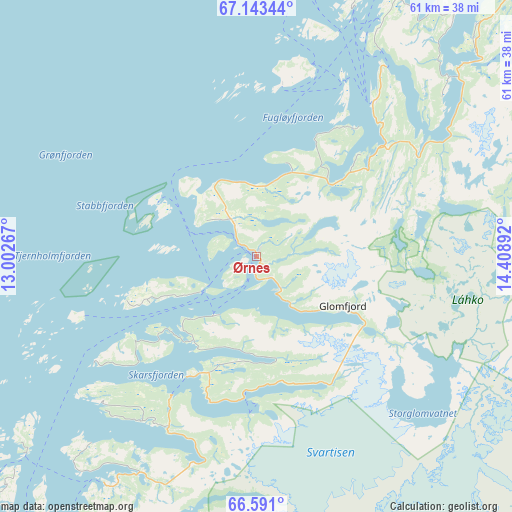
Ørnes GPS coordinates[2]
66° 52' 7.608" North, 13° 42' 20.844" East
| Map corner | latitude | longitude |
|---|---|---|
| Upper-left | 67.14344°, | 13.00267° |
| Center: | 66.86878°, | 13.70579° |
| Lower-right: | 66.591°, | 14.40892° |
| Map W x H: | 61.4×61.4 km | = 38.2×38.2mi |
| max Lat: | 71.04137° ⇑13.4% North |
| Ørnes: | 66.86878° |
| min Lat: | ⇓86.6% South 58.0274° |
| min Long | Ørnes | max Long |
| 4.71485° | 13.70579° | 31.11066° |
| W 86.7%⇐ | ⇒13.3% E |
Elevation
Elevation of Ørnes is 40 m = 131 ft, and this is 64.2 m = 211 ft below average elevation for this country.
| Max E: |
897 m = 2943 ft | 52.7% |
| Avg. | 104.2 m = 342 ft | |
| Ørnes | 40 m = 131 ft | |
Min E: |
1 m = 3 ft | 47.3% |
See also: Norway elevation on elevation.city.
Geographical zone
Ørnes is located in North Frigid zone (between North Pole and Arctic Circle). Distance of this North polar circle is 33.9 km =21.1 mi to South.| Distance of | km | miles | from Ørnes |
|---|---|---|---|
| North Pole | 2572 | 1598.2 | to North |
| Arctic Circle | 33.9 | 21.1 | to South |
| Tropic Cancer | 4829.2 | 3000.7 | to South |
| Equator | 7435.1 | 4620 | to South |


Nearby cities:
15 places around Ørnes: (largest is in red/bold)
• Bodø
54.8 km =34.1 mi,  33°
33°
• Glomfjord
11.9 km =7.4 mi,  119°
119°
• Hauknes
67 km =41.6 mi,  166°
166°
• Hemnesberget
71.7 km =44.6 mi,  183°
183°
• Husøya
81.7 km =50.8 mi,  240°
240°
• Inndyr
23 km =14.3 mi,  37°
37°
• Lurøy
62.9 km =39.1 mi,  217°
217°
• Løding
65.6 km =40.8 mi, 42°
• Løpsmarka
59 km =36.7 mi, 33°
• Mo i Rana
64.8 km =40.3 mi,  162°
162°
• Moldjord
40.8 km =25.4 mi,  68°
68°
• Nesna
80.5 km =50 mi,  202°
202°
• Rognan
77.6 km =48.2 mi, 70°
• Storforshei
63.1 km =39.2 mi,  144°
144°
• Vågaholmen
25.2 km =15.7 mi,  226°
226°
Sources, notices
• [Note1] Compared only with cities in Norway existing in our database
• [Src1] Map data: © OpenStreetMap contributors (CC-BY-SA)
• [Src2] Other city data from geonames.org with taken over terms of usage.
• [Src3] Geographical zone / Annual Mean Temperature by Robert A. Rohde @ Wikipedia
