Glomfjord geodata
Glomfjord (Nordland) is a populated place; located in Norway in Europe/Oslo (GMT+2) time zone. With population of 1,204 people, there are 269 cities with bigger population in this country. Compared to other cities in Norway, 86.4% of cities are located further ↓South; 87.3% of cities are located further ←West and 62.5% of cities have lower elevation than Glomfjord. Note1


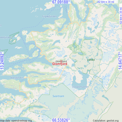
Glomfjord GPS coordinates[2]
66° 48' 59.868" North, 13° 56' 38.544" East
| Map corner | latitude | longitude |
|---|---|---|
| Upper-left | 67.09188°, | 13.24092° |
| Center: | 66.81663°, | 13.94404° |
| Lower-right: | 66.53826°, | 14.64717° |
| Map W x H: | 61.6×61.6 km | = 38.3×38.3mi |
| max Lat: | 71.04137° ⇑13.6% North |
| Glomfjord: | 66.81663° |
| min Lat: | ⇓86.4% South 58.0274° |
| min Long | Glomfjord | max Long |
| 4.71485° | 13.94404° | 31.11066° |
| W 87.3%⇐ | ⇒12.7% E |
Elevation
Elevation of Glomfjord is 80 m = 262 ft, and this is 24.2 m = 79 ft below average elevation for this country.
| Max E: |
897 m = 2943 ft | 37.5% |
| Avg. | 104.2 m = 342 ft | |
| Glomfjord | 80 m = 262 ft | |
Min E: |
1 m = 3 ft | 62.5% |
See also: Norway elevation on elevation.city.
Geographical zone
Glomfjord is located in North Frigid zone (between North Pole and Arctic Circle). Distance of this North polar circle is 28.1 km =17.5 mi to South.| Distance of | km | miles | from Glomfjord |
|---|---|---|---|
| North Pole | 2577.7 | 1601.7 | to North |
| Arctic Circle | 28.1 | 17.5 | to South |
| Tropic Cancer | 4823.4 | 2997.1 | to South |
| Equator | 7429.3 | 4616.4 | to South |


Nearby cities:
15 places around Glomfjord: (largest is in red/bold)
• Bodø
55.3 km =34.4 mi,  21°
21°
• Fauske
79.8 km =49.6 mi,  51°
51°
• Hauknes
59.5 km =37 mi,  174°
174°
• Hemnesberget
67.4 km =41.9 mi,  192°
192°
• Inndyr
24.4 km =15.2 mi,  8°
8°
• Lurøy
65.7 km =40.8 mi,  227°
227°
• Løding
63.9 km =39.7 mi,  32°
32°
• Løpsmarka
59.4 km =36.9 mi, 21°
• Mo i Rana
56.7 km =35.2 mi, 171°
• Moldjord
34.6 km =21.5 mi, 52°
• Nesna
80.1 km =49.8 mi,  210°
210°
• Rognan
70.4 km =43.7 mi,  63°
63°
• Storforshei
52.6 km =32.7 mi,  150°
150°
• Vågaholmen
31 km =19.3 mi,  248°
248°
• Ørnes
11.9 km =7.4 mi,  299°
299°
Sources, notices
• [Note1] Compared only with cities in Norway existing in our database
• [Src1] Map data: © OpenStreetMap contributors (CC-BY-SA)
• [Src2] Other city data from geonames.org with taken over terms of usage.
• [Src3] Geographical zone / Annual Mean Temperature by Robert A. Rohde @ Wikipedia
