Leland geodata
Leland (Nordland) is a seat of a second-order administrative division; located in Norway in Europe/Oslo (GMT+2) time zone. With population of 563 people, there are 439 cities with bigger population in this country. Compared to other cities in Norway, 84.7% of cities are located further ↓South; 84.5% of cities are located further ←West and 81.6% of cities have higher elevation than Leland. Note1


Leland GPS coordinates[2]
66° 3' 50.616" North, 12° 56' 35.7" East
| Map corner | latitude | longitude |
|---|---|---|
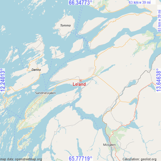
| Upper-left | 66.34773°, | 12.24013° |
| Center: | 66.06406°, | 12.94325° |
| Lower-right: | 65.77719°, | 13.64638° |
| Map W x H: | 63.4×63.4 km | = 39.4×39.4mi |
| max Lat: | 71.04137° ⇑15.3% North |
| Leland: | 66.06406° |
| min Lat: | ⇓84.7% South 58.0274° |
| min Long | Leland | max Long |
| 4.71485° | 12.94325° | 31.11066° |
| W 84.5%⇐ | ⇒15.5% E |
Elevation
Elevation of Leland is 10 m = 33 ft, and this is 94.2 m = 309 ft below average elevation for this country.
| Max E: |
897 m = 2943 ft | 81.6% |
| Avg. | 104.2 m = 342 ft | |
| Leland | 10 m = 33 ft | |
Min E: |
1 m = 3 ft | 18.4% |
See also: Norway elevation on elevation.city.
Geographical zone
Leland is located in North temperate zone (between Tropic of Cancer and the Arctic Circle). Distance of this North polar circle is 55.5 km =34.5 mi to North.| Distance of | km | miles | from Leland |
|---|---|---|---|
| North Pole | 2661.4 | 1653.7 | to North |
| Arctic Circle | 55.5 | 34.5 | to North |
| Tropic Cancer | 4739.7 | 2945.1 | to South |
| Equator | 7345.6 | 4564.3 | to South |


Nearby cities:
15 places around Leland: (largest is in red/bold)
• Gladstad
62 km =38.5 mi,  226°
226°
• Hattfjelldal
70.4 km =43.7 mi,  137°
137°
• Hauknes
56 km =34.8 mi,  64°
64°
• Hemnesberget
35.2 km =21.9 mi, 59°
• Husøya
61.7 km =38.3 mi,  322°
322°
• Korgen
39.6 km =24.6 mi,  87°
87°
• Lurøy
39.7 km =24.7 mi,  353°
353°
• Mo i Rana
60.5 km =37.6 mi, 62°
• Mosjøen
27.7 km =17.2 mi,  156°
156°
• Nesna
15.3 km =9.5 mi,  12°
12°
• Sandnessjøen
14.8 km =9.2 mi,  251°
251°
• Silvalen
30.9 km =19.2 mi, 253°
• Solfjellsjøen
21.5 km =13.4 mi,  285°
285°
• Trofors
62.7 km =39 mi, 160°
• Vevelstad
46.8 km =29.1 mi,  209°
209°
Sources, notices
• [Note1] Compared only with cities in Norway existing in our database
• [Src1] Map data: © OpenStreetMap contributors (CC-BY-SA)
• [Src2] Other city data from geonames.org with taken over terms of usage.
• [Src3] Geographical zone / Annual Mean Temperature by Robert A. Rohde @ Wikipedia
