Hauknes geodata
Hauknes (Nordland) is a populated place; located in Norway in Europe/Oslo (GMT+2) time zone. With population of 1,864 people, there are 213 cities with bigger population in this country. Compared to other cities in Norway, 85.4% of cities are located further ↓South; 87.8% of cities are located further ←West and 94.6% of cities have lower elevation than Hauknes. Note1


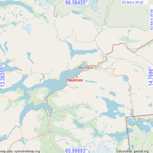
Hauknes GPS coordinates[2]
66° 16' 59.988" North, 14° 4' 0.012" East
| Map corner | latitude | longitude |
|---|---|---|
| Upper-left | 66.56455°, | 13.36355° |
| Center: | 66.28333°, | 14.06667° |
| Lower-right: | 65.99893°, | 14.7698° |
| Map W x H: | 62.9×62.9 km | = 39.1×39.1mi |
| max Lat: | 71.04137° ⇑14.6% North |
| Hauknes: | 66.28333° |
| min Lat: | ⇓85.4% South 58.0274° |
| min Long | Hauknes | max Long |
| 4.71485° | 14.06667° | 31.11066° |
| W 87.8%⇐ | ⇒12.2% E |
Elevation
Elevation of Hauknes is 420 m = 1378 ft, and this is 315.8 m = 1036 ft above average elevation for this country.
| Max E: |
897 m = 2943 ft | 5.4% |
| Hauknes | 420 m 1378 ft | |
| Avg. | 104.2 m = 342 ft | |
Min E: |
1 m = 3 ft | 94.6% |
See also: Norway elevation on elevation.city.
Geographical zone
Hauknes is located in North temperate zone (between Tropic of Cancer and the Arctic Circle). Distance of this North polar circle is 31.2 km =19.4 mi to North.| Distance of | km | miles | from Hauknes |
|---|---|---|---|
| North Pole | 2637 | 1638.6 | to North |
| Arctic Circle | 31.2 | 19.4 | to North |
| Tropic Cancer | 4764.1 | 2960.3 | to South |
| Equator | 7370 | 4579.5 | to South |


Nearby cities:
15 places around Hauknes: (largest is in red/bold)
• Glomfjord
59.5 km =37 mi,  354°
354°
• Hattfjelldal
76.4 km =47.5 mi,  182°
182°
• Hemnesberget
21.2 km =13.2 mi,  252°
252°
• Korgen
25.5 km =15.8 mi,  205°
205°
• Leland
56 km =34.8 mi,  244°
244°
• Lurøy
56.6 km =35.2 mi,  285°
285°
• Mo i Rana
4.7 km =2.9 mi,  46°
46°
• Moldjord
83.4 km =51.8 mi,  15°
15°
• Mosjøen
63.5 km =39.5 mi,  218°
218°
• Nesna
47.9 km =29.8 mi,  258°
258°
• Sandnessjøen
70.8 km =44 mi, 245°
• Solfjellsjøen
73.4 km =45.6 mi, 255°
• Storforshei
24.6 km =15.3 mi,  56°
56°
• Vågaholmen
59 km =36.7 mi,  324°
324°
• Ørnes
67 km =41.6 mi, 346°
Sources, notices
• [Note1] Compared only with cities in Norway existing in our database
• [Src1] Map data: © OpenStreetMap contributors (CC-BY-SA)
• [Src2] Other city data from geonames.org with taken over terms of usage.
• [Src3] Geographical zone / Annual Mean Temperature by Robert A. Rohde @ Wikipedia
