Kautokeino geodata
Kautokeino (Finnmark) is a seat of a second-order administrative division; located in Norway in Europe/Oslo (GMT+2) time zone. With population of 2,000 people, there are 200 cities with bigger population in this country. Compared to other cities in Norway, 93.8% of cities are located further ↓South; 97.2% of cities are located further ←West and 91.3% of cities have lower elevation than Kautokeino. Note1


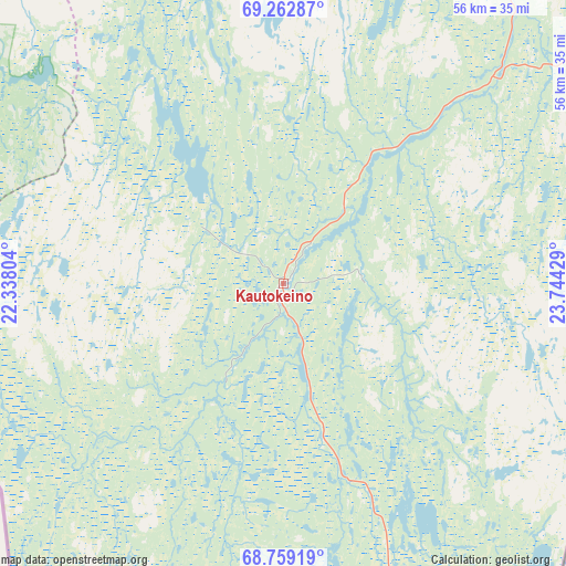
Kautokeino GPS coordinates[2]
69° 0' 44.892" North, 23° 2' 28.176" East
| Map corner | latitude | longitude |
|---|---|---|
| Upper-left | 69.26287°, | 22.33804° |
| Center: | 69.01247°, | 23.04116° |
| Lower-right: | 68.75919°, | 23.74429° |
| Map W x H: | 56×56 km | = 34.8×34.8mi |
| max Lat: | 71.04137° ⇑6.2% North |
| Kautokeino: | 69.01247° |
| min Lat: | ⇓93.8% South 58.0274° |
| min Long | Kautokeino | max Long |
| 4.71485° | 23.04116° | 31.11066° |
| W 97.2%⇐ | ⇒2.8% E |
Elevation
Elevation of Kautokeino is 319 m = 1047 ft, and this is 214.8 m = 705 ft above average elevation for this country.
| Max E: |
897 m = 2943 ft | 8.7% |
| Kautokeino | 319 m 1047 ft | |
| Avg. | 104.2 m = 342 ft | |
Min E: |
1 m = 3 ft | 91.3% |
See also: Norway elevation on elevation.city.
Geographical zone
Kautokeino is located in North Frigid zone (between North Pole and Arctic Circle). Distance of this North polar circle is 272.3 km =169.2 mi to South.| Distance of | km | miles | from Kautokeino |
|---|---|---|---|
| North Pole | 2333.6 | 1450 | to North |
| Arctic Circle | 272.3 | 169.2 | to South |
| Tropic Cancer | 5067.5 | 3148.8 | to South |
| Equator | 7673.5 | 4768.1 | to South |


Nearby cities:
15 places around Kautokeino: (largest is in red/bold)
• Alta
106.7 km =66.3 mi,  4°
4°
• Breivikbotn
177.6 km =110.4 mi,  350°
350°
• Burfjord
109.9 km =68.3 mi,  339°
339°
• Hansnes
170.1 km =105.7 mi,  308°
308°
• Hatteng
125.3 km =77.9 mi,  283°
283°
• Kvalsund
169.6 km =105.4 mi,  12°
12°
• Kárášjohka
109.9 km =68.3 mi,  62°
62°
• Lakselv
137.7 km =85.6 mi,  33°
33°
• Lyngseidet
127.4 km =79.2 mi,  299°
299°
• Olderdalen
118.5 km =73.6 mi, 303°
• Rypefjord
182.7 km =113.5 mi, 7°
• Skjervøy
138.9 km =86.3 mi,  324°
324°
• Storslett
115.2 km =71.6 mi, 316°
• Storsteinnes
152.9 km =95 mi, 279°
• Øksfjord
139 km =86.4 mi, 348°
Sources, notices
• [Note1] Compared only with cities in Norway existing in our database
• [Src1] Map data: © OpenStreetMap contributors (CC-BY-SA)
• [Src2] Other city data from geonames.org with taken over terms of usage.
• [Src3] Geographical zone / Annual Mean Temperature by Robert A. Rohde @ Wikipedia
