Palmarito geodata
Palmarito (Chiriquí) is a populated place; located in Panama in America/Panama (GMT-5) time zone. With population of 797 people, there are 324 cities with bigger population in this country. Compared to other cities in Panama, 74.7% of cities are located further ↓South; 97.5% of cities are located further →East and 97% of cities have lower elevation than Palmarito. Note1


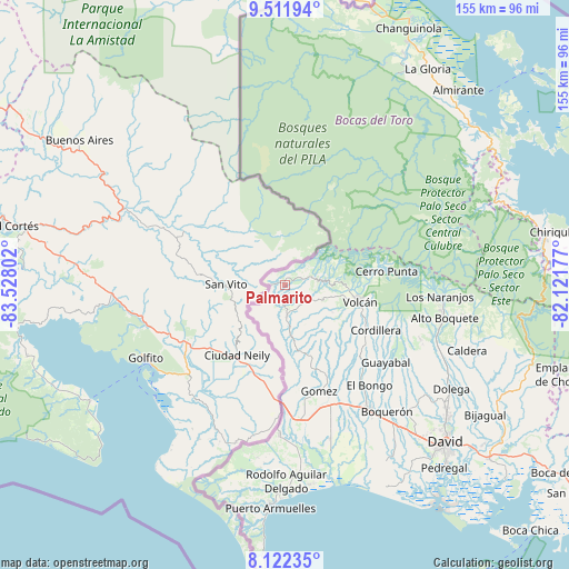
Palmarito GPS coordinates[2]
8° 49' 4.08" North, 82° 49' 29.604" West
| Map corner | latitude | longitude |
|---|---|---|
| Upper-left | 9.51194°, | -83.52802° |
| Center: | 8.8178°, | -82.82489° |
| Lower-right: | 8.12235°, | -82.12177° |
| Map W x H: | 154.5×154.5 km | = 96×96mi |
| max Lat: | 9.60898° ⇑25.3% North |
| Palmarito: | 8.8178° |
| min Lat: | ⇓74.7% South 7.26534° |
| min Long | Palmarito | max Long |
| -82.91275° | -82.82489° | -77.38965° |
| W 2.5%⇐ | ⇒97.5% E |
Elevation
Elevation of Palmarito is 935 m = 3068 ft, and this is 762.9 m = 2503 ft above average elevation for this country.
| Max E: |
2103 m = 6900 ft | 3% |
| Palmarito | 935 m 3068 ft | |
| Avg. | 172.1 m = 565 ft | |
Min E: |
-1 m = -3 ft | 97% |
See also: Panama elevation on elevation.city.
Geographical zone
Palmarito is located in North Torrid zone (between Equator and Tropic of Cancer). Distance of Equator is 980.4 km =609.2 mi to South.| Distance of | km | miles | from Palmarito |
|---|---|---|---|
| North Pole | 9026.6 | 5608.9 | to North |
| Arctic Circle | 6420.7 | 3989.6 | to North |
| Tropic Cancer | 1625.5 | 1010 | to North |
| Equator | 980.4 | 609.2 | to South |


Nearby cities:
15 places around Palmarito: (largest is in red/bold)
• Alto Quiel
12.7 km =7.9 mi,  219°
219°
• Breñón
21.5 km =13.4 mi,  176°
176°
• Cañas Gordas
12.7 km =7.9 mi,  229°
229°
• Cordillera
27.3 km =17 mi,  116°
116°
• La Bonita
23.1 km =14.4 mi,  163°
163°
• Miraflores
2.9 km =1.8 mi,  352°
352°
• Monte Lirio
3.2 km =2 mi,  187°
187°
• Piedra Candela
10.5 km =6.5 mi,  47°
47°
• Plaza de Caisán
9 km =5.6 mi, 176°
• Río Sereno
3.6 km =2.2 mi,  269°
269°
• San Andrés
26.3 km =16.3 mi, 155°
• San Francisco
23 km =14.3 mi,  152°
152°
• Santa Clara
5.3 km =3.3 mi,  70°
70°
• Santa Cruz
20.8 km =12.9 mi, 159°
• Volcán
21.1 km =13.1 mi,  103°
103°
Sources, notices
• [Note1] Compared only with cities in Panama existing in our database
• [Src1] Map data: © OpenStreetMap contributors (CC-BY-SA)
• [Src2] Other city data from geonames.org with taken over terms of usage.
• [Src3] Geographical zone / Annual Mean Temperature by Robert A. Rohde @ Wikipedia
