Santa Clara geodata
Santa Clara (Chiriquí) is a populated place; located in Panama in America/Panama (GMT-5) time zone. With population of 1,360 people, there are 178 cities with bigger population in this country. Compared to other cities in Panama, 75.1% of cities are located further ↓South; 95.7% of cities are located further →East and 98.9% of cities have lower elevation than Santa Clara. Note1


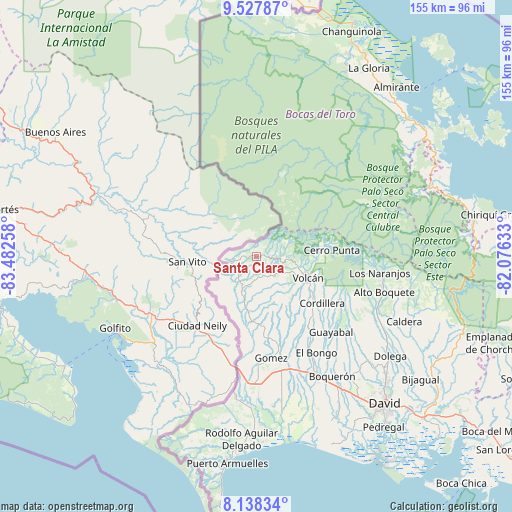
Santa Clara GPS coordinates[2]
8° 50' 1.536" North, 82° 46' 46.02" West
| Map corner | latitude | longitude |
|---|---|---|
| Upper-left | 9.52787°, | -83.48258° |
| Center: | 8.83376°, | -82.77945° |
| Lower-right: | 8.13834°, | -82.07633° |
| Map W x H: | 154.5×154.5 km | = 96×96mi |
| max Lat: | 9.60898° ⇑24.9% North |
| Santa Clara: | 8.83376° |
| min Lat: | ⇓75.1% South 7.26534° |
| min Long | Santa Clara | max Long |
| -82.91275° | -82.77945° | -77.38965° |
| W 4.3%⇐ | ⇒95.7% E |
Elevation
Elevation of Santa Clara is 1178 m = 3865 ft, and this is 1005.9 m = 3300 ft above average elevation for this country.
| Max E: |
2103 m = 6900 ft | 1.1% |
| Santa Clara | 1178 m 3865 ft | |
| Avg. | 172.1 m = 565 ft | |
Min E: |
-1 m = -3 ft | 98.9% |
See also: Panama elevation on elevation.city.
Geographical zone
Santa Clara is located in North Torrid zone (between Equator and Tropic of Cancer). Distance of Equator is 982.2 km =610.3 mi to South.| Distance of | km | miles | from Santa Clara |
|---|---|---|---|
| North Pole | 9024.8 | 5607.7 | to North |
| Arctic Circle | 6419 | 3988.6 | to North |
| Tropic Cancer | 1623.7 | 1008.9 | to North |
| Equator | 982.2 | 610.3 | to South |


Nearby cities:
15 places around Santa Clara: (largest is in red/bold)
• Alto Quiel
17.5 km =10.9 mi,  228°
228°
• Barrio Guadalupe
23.8 km =14.8 mi,  81°
81°
• Breñón
23.5 km =14.6 mi,  188°
188°
• Cañas Gordas
17.8 km =11.1 mi,  235°
235°
• Cerro Punta
22.8 km =14.2 mi,  85°
85°
• La Bonita
23.9 km =14.9 mi,  175°
175°
• Miraflores
5.5 km =3.4 mi,  282°
282°
• Monte Lirio
7.3 km =4.5 mi, 227°
• Palmarito
5.3 km =3.3 mi,  250°
250°
• Piedra Candela
6 km =3.7 mi,  28°
28°
• Plaza de Caisán
11.7 km =7.3 mi,  202°
202°
• Río Sereno
8.7 km =5.4 mi,  258°
258°
• San Francisco
22.9 km =14.2 mi,  165°
165°
• Santa Cruz
21.4 km =13.3 mi, 174°
• Volcán
16.9 km =10.5 mi,  113°
113°
Sources, notices
• [Note1] Compared only with cities in Panama existing in our database
• [Src1] Map data: © OpenStreetMap contributors (CC-BY-SA)
• [Src2] Other city data from geonames.org with taken over terms of usage.
• [Src3] Geographical zone / Annual Mean Temperature by Robert A. Rohde @ Wikipedia
