Los Higos geodata
Los Higos (Veraguas) is a seat of a third-order administrative division; located in Panama in America/Panama (GMT-5) time zone. With population of 127 people, there are 640 cities with bigger population in this country. Compared to other cities in Panama, 72.3% of cities are located further ↑North; 58.4% of cities are located further →East and 60.2% of cities have higher elevation than Los Higos. Note1


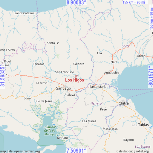
Los Higos GPS coordinates[2]
8° 12' 19.908" North, 80° 51' 36.792" West
| Map corner | latitude | longitude |
|---|---|---|
| Upper-left | 8.90083°, | -81.56335° |
| Center: | 8.20553°, | -80.86022° |
| Lower-right: | 7.50901°, | -80.1571° |
| Map W x H: | 154.8×154.8 km | = 96.2×96.2mi |
| max Lat: | 9.60898° ⇑72.3% North |
| Los Higos: | 8.20553° |
| min Lat: | ⇓27.7% South 7.26534° |
| min Long | Los Higos | max Long |
| -82.91275° | -80.86022° | -77.38965° |
| W 41.6%⇐ | ⇒58.4% E |
Elevation
Elevation of Los Higos is 52 m = 171 ft, and this is 120.1 m = 394 ft below average elevation for this country.
| Max E: |
2103 m = 6900 ft | 60.2% |
| Avg. | 172.1 m = 565 ft | |
| Los Higos | 52 m = 171 ft | |
Min E: |
-1 m = -3 ft | 39.8% |
See also: Panama elevation on elevation.city.
Geographical zone
Los Higos is located in North Torrid zone (between Equator and Tropic of Cancer). Distance of Equator is 912.4 km =566.9 mi to South.| Distance of | km | miles | from Los Higos |
|---|---|---|---|
| North Pole | 9094.7 | 5651.2 | to North |
| Arctic Circle | 6488.8 | 4032 | to North |
| Tropic Cancer | 1693.5 | 1052.3 | to North |
| Equator | 912.4 | 566.9 | to South |


Nearby cities:
15 places around Los Higos: (largest is in red/bold)
• Boquerón
4.3 km =2.7 mi,  1°
1°
• Calobre
12.8 km =8 mi,  9°
9°
• Canto del Llano
14.5 km =9 mi,  231°
231°
• El Coclá
14.5 km =9 mi,  332°
332°
• El Espino
10.8 km =6.7 mi,  263°
263°
• El Espino de Santa Rosa
13.2 km =8.2 mi,  162°
162°
• El Pedernal
11.1 km =6.9 mi,  129°
129°
• La Mata
13.1 km =8.1 mi,  189°
189°
• La Raya de Calobre
3.8 km =2.4 mi,  71°
71°
• La Raya de Santa María
6.3 km =3.9 mi,  137°
137°
• La Soledad
16.3 km =10.1 mi,  241°
241°
• Las Guías Abajo
11.7 km =7.3 mi,  96°
96°
• Los Boquerones
14.1 km =8.8 mi,  177°
177°
• Punta Delgadita
14.2 km =8.8 mi,  221°
221°
• San Francisco
13.4 km =8.3 mi,  289°
289°
Sources, notices
• [Note1] Compared only with cities in Panama existing in our database
• [Src1] Map data: © OpenStreetMap contributors (CC-BY-SA)
• [Src2] Other city data from geonames.org with taken over terms of usage.
• [Src3] Geographical zone / Annual Mean Temperature by Robert A. Rohde @ Wikipedia
