El Coclá geodata
El Coclá (Veraguas) is a seat of a third-order administrative division; located in Panama in America/Panama (GMT-5) time zone. With population of 32 people, there are 690 cities with bigger population in this country. Compared to other cities in Panama, 65% of cities are located further ↑North; 59.7% of cities are located further →East and 79% of cities have lower elevation than El Coclá. Note1


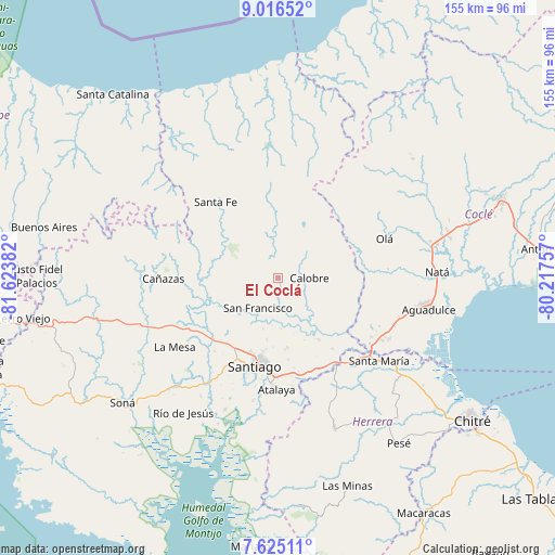
El Coclá GPS coordinates[2]
8° 19' 17.148" North, 80° 55' 14.484" West
| Map corner | latitude | longitude |
|---|---|---|
| Upper-left | 9.01652°, | -81.62382° |
| Center: | 8.32143°, | -80.92069° |
| Lower-right: | 7.62511°, | -80.21757° |
| Map W x H: | 154.7×154.7 km | = 96.1×96.1mi |
| max Lat: | 9.60898° ⇑65% North |
| El Coclá: | 8.32143° |
| min Lat: | ⇓35% South 7.26534° |
| min Long | El Coclá | max Long |
| -82.91275° | -80.92069° | -77.38965° |
| W 40.3%⇐ | ⇒59.7% E |
Elevation
Elevation of El Coclá is 250 m = 820 ft, and this is 77.9 m = 256 ft above average elevation for this country.
| Max E: |
2103 m = 6900 ft | 21% |
| El Coclá | 250 m 820 ft | |
| Avg. | 172.1 m = 565 ft | |
Min E: |
-1 m = -3 ft | 79% |
See also: Panama elevation on elevation.city.
Geographical zone
El Coclá is located in North Torrid zone (between Equator and Tropic of Cancer). Distance of Equator is 925.3 km =575 mi to South.| Distance of | km | miles | from El Coclá |
|---|---|---|---|
| North Pole | 9081.8 | 5643.2 | to North |
| Arctic Circle | 6475.9 | 4023.9 | to North |
| Tropic Cancer | 1680.7 | 1044.3 | to North |
| Equator | 925.3 | 575 | to South |


Nearby cities:
15 places around El Coclá: (largest is in red/bold)
• Barnizal
18.3 km =11.4 mi,  59°
59°
• Boquerón
11 km =6.8 mi,  141°
141°
• Calabacito
19.5 km =12.1 mi,  245°
245°
• Calobre
8.8 km =5.5 mi,  91°
91°
• El Espino
14.8 km =9.2 mi,  196°
196°
• El Peñón
6.9 km =4.3 mi,  297°
297°
• El Potrero
15.2 km =9.4 mi,  66°
66°
• La Raya de Calobre
15.6 km =9.7 mi, 138°
• La Raya de Santa María
20.6 km =12.8 mi,  147°
147°
• La Yeguada
14 km =8.7 mi,  29°
29°
• Los Higos
14.5 km =9 mi, 152°
• Monjarás
8 km =5 mi,  48°
48°
• San Francisco
10.2 km =6.3 mi,  215°
215°
• San José
20.6 km =12.8 mi,  38°
38°
• San Juan
10.7 km =6.6 mi,  258°
258°
Sources, notices
• [Note1] Compared only with cities in Panama existing in our database
• [Src1] Map data: © OpenStreetMap contributors (CC-BY-SA)
• [Src2] Other city data from geonames.org with taken over terms of usage.
• [Src3] Geographical zone / Annual Mean Temperature by Robert A. Rohde @ Wikipedia
