La Raya de Calobre geodata
La Raya de Calobre (Veraguas) is a seat of a third-order administrative division; located in Panama in America/Panama (GMT-5) time zone. With population of 233 people, there are 588 cities with bigger population in this country. Compared to other cities in Panama, 71.5% of cities are located further ↑North; 57.4% of cities are located further →East and 59.7% of cities have higher elevation than La Raya de Calobre. Note1


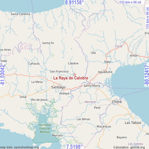
La Raya de Calobre GPS coordinates[2]
8° 12' 58.68" North, 80° 49' 38.244" West
| Map corner | latitude | longitude |
|---|---|---|
| Upper-left | 8.91158°, | -81.53042° |
| Center: | 8.2163°, | -80.82729° |
| Lower-right: | 7.5198°, | -80.12417° |
| Map W x H: | 154.8×154.8 km | = 96.2×96.2mi |
| max Lat: | 9.60898° ⇑71.5% North |
| La Raya de Calobre: | 8.2163° |
| min Lat: | ⇓28.5% South 7.26534° |
| min Long | La Raya de Calo | max Long |
| -82.91275° | -80.82729° | -77.38965° |
| W 42.6%⇐ | ⇒57.4% E |
Elevation
Elevation of La Raya de Calobre is 53 m = 174 ft, and this is 119.1 m = 391 ft below average elevation for this country.
| Max E: |
2103 m = 6900 ft | 59.7% |
| Avg. | 172.1 m = 565 ft | |
| La Raya de Calobre | 53 m = 174 ft | |
Min E: |
-1 m = -3 ft | 40.3% |
See also: Panama elevation on elevation.city.
Geographical zone
La Raya de Calobre is located in North Torrid zone (between Equator and Tropic of Cancer). Distance of Equator is 913.6 km =567.7 mi to South.| Distance of | km | miles | from La Raya de Calobre |
|---|---|---|---|
| North Pole | 9093.5 | 5650.4 | to North |
| Arctic Circle | 6487.6 | 4031.2 | to North |
| Tropic Cancer | 1692.4 | 1051.6 | to North |
| Equator | 913.6 | 567.7 | to South |


Nearby cities:
15 places around La Raya de Calobre: (largest is in red/bold)
• Boquerón
4.7 km =2.9 mi,  311°
311°
• Calobre
11.5 km =7.1 mi,  352°
352°
• Cañazas
14.6 km =9.1 mi,  124°
124°
• Chupampa
16.5 km =10.3 mi,  160°
160°
• El Barrero
16.3 km =10.1 mi,  114°
114°
• El Coclá
15.6 km =9.7 mi,  318°
318°
• El Espino
14.6 km =9.1 mi,  260°
260°
• El Espino de Santa Rosa
13.7 km =8.5 mi,  178°
178°
• El Pedernal
9.6 km =6 mi,  149°
149°
• La Mata
15.2 km =9.4 mi,  202°
202°
• La Raya de Santa María
5.8 km =3.6 mi,  173°
173°
• Las Guías Abajo
8.3 km =5.2 mi, 106°
• Llano Sánchez
13.6 km =8.5 mi,  98°
98°
• Los Boquerones
15.6 km =9.7 mi,  191°
191°
• Los Higos
3.8 km =2.4 mi,  251°
251°
Sources, notices
• [Note1] Compared only with cities in Panama existing in our database
• [Src1] Map data: © OpenStreetMap contributors (CC-BY-SA)
• [Src2] Other city data from geonames.org with taken over terms of usage.
• [Src3] Geographical zone / Annual Mean Temperature by Robert A. Rohde @ Wikipedia
