Los Corotúes geodata
Los Corotúes (Veraguas) is a seat of a third-order administrative division; located in Panama in America/Panama (GMT-5) time zone. In our database, there are 694 cities with bigger population. Compared to other cities in Panama, 55.8% of cities are located further ↑North; 63.6% of cities are located further →East and 83.6% of cities have lower elevation than Los Corotúes. Note1


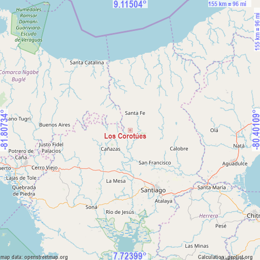
Los Corotúes GPS coordinates[2]
8° 25' 12.504" North, 81° 6' 15.156" West
| Map corner | latitude | longitude |
|---|---|---|
| Upper-left | 9.11504°, | -81.80734° |
| Center: | 8.42014°, | -81.10421° |
| Lower-right: | 7.72399°, | -80.40109° |
| Map W x H: | 154.7×154.7 km | = 96.1×96.1mi |
| max Lat: | 9.60898° ⇑55.8% North |
| Los Corotúes: | 8.42014° |
| min Lat: | ⇓44.2% South 7.26534° |
| min Long | Los Corotúes | max Long |
| -82.91275° | -81.10421° | -77.38965° |
| W 36.4%⇐ | ⇒63.6% E |
Elevation
Elevation of Los Corotúes is 324 m = 1063 ft, and this is 151.9 m = 498 ft above average elevation for this country.
| Max E: |
2103 m = 6900 ft | 16.4% |
| Los Corotúes | 324 m 1063 ft | |
| Avg. | 172.1 m = 565 ft | |
Min E: |
-1 m = -3 ft | 83.6% |
See also: Panama elevation on elevation.city.
Geographical zone
Los Corotúes is located in North Torrid zone (between Equator and Tropic of Cancer). Distance of Equator is 936.2 km =581.7 mi to South.| Distance of | km | miles | from Los Corotúes |
|---|---|---|---|
| North Pole | 9070.8 | 5636.3 | to North |
| Arctic Circle | 6464.9 | 4017.1 | to North |
| Tropic Cancer | 1669.7 | 1037.5 | to North |
| Equator | 936.2 | 581.7 | to South |


Nearby cities:
15 places around Los Corotúes: (largest is in red/bold)
• Calabacito
19.3 km =12 mi,  172°
172°
• Cañazas
16.2 km =10.1 mi,  226°
226°
• El Alto
12.6 km =7.8 mi,  36°
36°
• El Coclá
23 km =14.3 mi,  118°
118°
• El Pantano
13.6 km =8.5 mi,  16°
16°
• El Peñón
16.1 km =10 mi, 118°
• El Picador
17.4 km =10.8 mi,  254°
254°
• Gatú
21.3 km =13.2 mi,  52°
52°
• Los Valles
10.9 km =6.8 mi,  286°
286°
• Paredón Arriba
11 km =6.8 mi, 293°
• Piedras Gordas
24.1 km =15 mi,  61°
61°
• San Francisco
24 km =14.9 mi,  143°
143°
• San Juan
16.2 km =10.1 mi, 143°
• San Marcelo
17.5 km =10.9 mi,  200°
200°
• Santa Fé
10.5 km =6.5 mi, 15°
Sources, notices
• [Note1] Compared only with cities in Panama existing in our database
• [Src1] Map data: © OpenStreetMap contributors (CC-BY-SA)
• [Src2] Other city data from geonames.org with taken over terms of usage.
• [Src3] Geographical zone / Annual Mean Temperature by Robert A. Rohde @ Wikipedia
