Cerro de Plata geodata
Cerro de Plata (Veraguas) is a seat of a third-order administrative division; located in Panama in America/Panama (GMT-5) time zone. In our database, there are 694 cities with bigger population. Compared to other cities in Panama, 67.5% of cities are located further ↑North; 68% of cities are located further →East and 67.6% of cities have lower elevation than Cerro de Plata. Note1


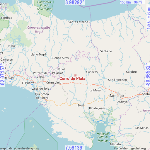
Cerro de Plata GPS coordinates[2]
8° 17' 15.972" North, 81° 22' 6.384" West
| Map corner | latitude | longitude |
|---|---|---|
| Upper-left | 8.98292°, | -82.07157° |
| Center: | 8.28777°, | -81.36844° |
| Lower-right: | 7.59139°, | -80.66532° |
| Map W x H: | 154.7×154.7 km | = 96.1×96.1mi |
| max Lat: | 9.60898° ⇑67.5% North |
| Cerro de Plata: | 8.28777° |
| min Lat: | ⇓32.5% South 7.26534° |
| min Long | Cerro de Plata | max Long |
| -82.91275° | -81.36844° | -77.38965° |
| W 32%⇐ | ⇒68% E |
Elevation
Elevation of Cerro de Plata is 138 m = 453 ft, and this is 34.1 m = 112 ft below average elevation for this country.
| Max E: |
2103 m = 6900 ft | 32.4% |
| Avg. | 172.1 m = 565 ft | |
| Cerro de Plata | 138 m = 453 ft | |
Min E: |
-1 m = -3 ft | 67.6% |
See also: Panama elevation on elevation.city.
Geographical zone
Cerro de Plata is located in North Torrid zone (between Equator and Tropic of Cancer). Distance of Equator is 921.5 km =572.6 mi to South.| Distance of | km | miles | from Cerro de Plata |
|---|---|---|---|
| North Pole | 9085.5 | 5645.5 | to North |
| Arctic Circle | 6479.7 | 4026.3 | to North |
| Tropic Cancer | 1684.4 | 1046.6 | to North |
| Equator | 921.5 | 572.6 | to South |


Nearby cities:
15 places around Cerro de Plata: (largest is in red/bold)
• Alto de Jesús
13.1 km =8.1 mi,  257°
257°
• Bajo Solis
18.9 km =11.7 mi,  290°
290°
• Bisvalles
20 km =12.4 mi,  125°
125°
• Boró
15.1 km =9.4 mi,  150°
150°
• Buenos Aires
19 km =11.8 mi,  317°
317°
• Cañazas
17.6 km =10.9 mi,  78°
78°
• El Bale
7.8 km =4.8 mi,  6°
6°
• El Picador
15.9 km =9.9 mi,  50°
50°
• El Piro
19.5 km =12.1 mi,  243°
243°
• El Prado
16 km =9.9 mi,  249°
249°
• El Rincón
13.5 km =8.4 mi,  211°
211°
• Las Palmas
19.5 km =12.1 mi, 209°
• San Bartolo
13.3 km =8.3 mi, 130°
• San José
10.2 km =6.3 mi,  336°
336°
• Viguí
15.4 km =9.6 mi, 291°
Sources, notices
• [Note1] Compared only with cities in Panama existing in our database
• [Src1] Map data: © OpenStreetMap contributors (CC-BY-SA)
• [Src2] Other city data from geonames.org with taken over terms of usage.
• [Src3] Geographical zone / Annual Mean Temperature by Robert A. Rohde @ Wikipedia
