Viguí geodata
Viguí (Veraguas) is a seat of a third-order administrative division; located in Panama in America/Panama (GMT-5) time zone. With population of 110 people, there are 652 cities with bigger population in this country. Compared to other cities in Panama, 64.1% of cities are located further ↑North; 69.8% of cities are located further →East and 81.1% of cities have lower elevation than Viguí. Note1


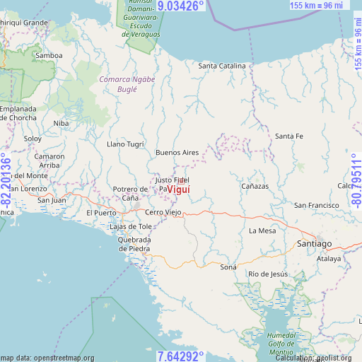
Viguí GPS coordinates[2]
8° 20' 21.156" North, 81° 29' 53.628" West
| Map corner | latitude | longitude |
|---|---|---|
| Upper-left | 9.03426°, | -82.20136° |
| Center: | 8.33921°, | -81.49823° |
| Lower-right: | 7.64292°, | -80.79511° |
| Map W x H: | 154.7×154.7 km | = 96.1×96.1mi |
| max Lat: | 9.60898° ⇑64.1% North |
| Viguí: | 8.33921° |
| min Lat: | ⇓35.9% South 7.26534° |
| min Long | Viguí | max Long |
| -82.91275° | -81.49823° | -77.38965° |
| W 30.2%⇐ | ⇒69.8% E |
Elevation
Elevation of Viguí is 274 m = 899 ft, and this is 101.9 m = 334 ft above average elevation for this country.
| Max E: |
2103 m = 6900 ft | 18.9% |
| Viguí | 274 m 899 ft | |
| Avg. | 172.1 m = 565 ft | |
Min E: |
-1 m = -3 ft | 81.1% |
See also: Panama elevation on elevation.city.
Geographical zone
Viguí is located in North Torrid zone (between Equator and Tropic of Cancer). Distance of Equator is 927.2 km =576.1 mi to South.| Distance of | km | miles | from Viguí |
|---|---|---|---|
| North Pole | 9079.8 | 5641.9 | to North |
| Arctic Circle | 6473.9 | 4022.7 | to North |
| Tropic Cancer | 1678.7 | 1043.1 | to North |
| Equator | 927.2 | 576.1 | to South |


Nearby cities:
15 places around Viguí: (largest is in red/bold)
• Alto de Jesús
8.8 km =5.5 mi,  169°
169°
• Bajo Solis
3.5 km =2.2 mi,  285°
285°
• Buenos Aires
8.4 km =5.2 mi,  10°
10°
• Cerro Caña
12.4 km =7.7 mi,  276°
276°
• Cerro Iglesias
7.6 km =4.7 mi,  252°
252°
• Cerro Plata
16.2 km =10.1 mi,  341°
341°
• Cerro Venado
14.9 km =9.3 mi,  214°
214°
• Cerro Viejo
12.9 km =8 mi,  222°
222°
• Cerro de Plata
15.4 km =9.6 mi,  111°
111°
• El Bale
15.2 km =9.4 mi,  82°
82°
• El Piro
14.8 km =9.2 mi,  192°
192°
• El Prado
11.3 km =7 mi,  183°
183°
• Llano Ñopo
16 km =9.9 mi,  304°
304°
• San José
10.9 km =6.8 mi,  70°
70°
• Sitio Prado
9.9 km =6.2 mi, 291°
Sources, notices
• [Note1] Compared only with cities in Panama existing in our database
• [Src1] Map data: © OpenStreetMap contributors (CC-BY-SA)
• [Src2] Other city data from geonames.org with taken over terms of usage.
• [Src3] Geographical zone / Annual Mean Temperature by Robert A. Rohde @ Wikipedia
