Loma Yuca geodata
Loma Yuca (Ngöbe-Buglé) is a seat of a third-order administrative division; located in Panama in America/Panama (GMT-5) time zone. With population of 17 people, there are 691 cities with bigger population in this country. Compared to other cities in Panama, 70.4% of cities are located further ↓South; 68.5% of cities are located further →East and 83.8% of cities have lower elevation than Loma Yuca. Note1


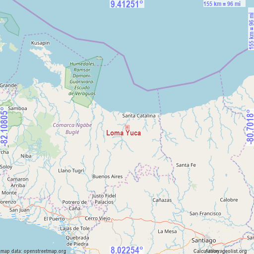
Loma Yuca GPS coordinates[2]
8° 43' 5.412" North, 81° 24' 17.712" West
| Map corner | latitude | longitude |
|---|---|---|
| Upper-left | 9.41251°, | -82.10805° |
| Center: | 8.71817°, | -81.40492° |
| Lower-right: | 8.02254°, | -80.7018° |
| Map W x H: | 154.6×154.6 km | = 96.1×96.1mi |
| max Lat: | 9.60898° ⇑29.6% North |
| Loma Yuca: | 8.71817° |
| min Lat: | ⇓70.4% South 7.26534° |
| min Long | Loma Yuca | max Long |
| -82.91275° | -81.40492° | -77.38965° |
| W 31.5%⇐ | ⇒68.5% E |
Elevation
Elevation of Loma Yuca is 325 m = 1066 ft, and this is 152.9 m = 502 ft above average elevation for this country.
| Max E: |
2103 m = 6900 ft | 16.2% |
| Loma Yuca | 325 m 1066 ft | |
| Avg. | 172.1 m = 565 ft | |
Min E: |
-1 m = -3 ft | 83.8% |
See also: Panama elevation on elevation.city.
Geographical zone
Loma Yuca is located in North Torrid zone (between Equator and Tropic of Cancer). Distance of Equator is 969.4 km =602.4 mi to South.| Distance of | km | miles | from Loma Yuca |
|---|---|---|---|
| North Pole | 9037.7 | 5615.8 | to North |
| Arctic Circle | 6431.8 | 3996.5 | to North |
| Tropic Cancer | 1636.5 | 1016.9 | to North |
| Equator | 969.4 | 602.4 | to South |


Nearby cities:
15 places around Loma Yuca: (largest is in red/bold)
• Agua de Salud
24.6 km =15.3 mi,  195°
195°
• Boca del Río Chiriquí
23.2 km =14.4 mi,  307°
307°
• Buenos Aires
34.9 km =21.7 mi,  194°
194°
• Calovébora
22.7 km =14.1 mi,  70°
70°
• Cerro Plata
30.9 km =19.2 mi,  210°
210°
• El Bale
40.4 km =25.1 mi,  173°
173°
• Guayabito
21.6 km =13.4 mi, 203°
• Güibale
23.4 km =14.5 mi, 168°
• Los Valles
37.6 km =23.4 mi,  142°
142°
• Mirones
39.5 km =24.5 mi,  243°
243°
• Paredón Arriba
36.8 km =22.9 mi, 141°
• Río Grande
16.9 km =10.5 mi,  130°
130°
• Río Luís
21.1 km =13.1 mi,  100°
100°
• San José
38.4 km =23.9 mi,  179°
179°
• Santa Catalina
11 km =6.8 mi,  50°
50°
Sources, notices
• [Note1] Compared only with cities in Panama existing in our database
• [Src1] Map data: © OpenStreetMap contributors (CC-BY-SA)
• [Src2] Other city data from geonames.org with taken over terms of usage.
• [Src3] Geographical zone / Annual Mean Temperature by Robert A. Rohde @ Wikipedia
