Tocache geodata
Tocache (San Martín) is a populated place; located in Peru in America/Lima (GMT-5) time zone. With population of 29,029 people, there are 60 cities with bigger population in this country. Compared to other cities in Peru, 72.8% of cities are located further ↓South; 59.6% of cities are located further →East and 77.9% of cities have higher elevation than Tocache. Note1


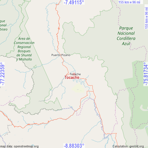
Tocache GPS coordinates[2]
8° 11' 15.72" South, 76° 31' 13.656" West
| Map corner | latitude | longitude |
|---|---|---|
| Upper-left | -7.49115°, | -77.22359° |
| Center: | -8.1877°, | -76.52046° |
| Lower-right: | -8.88303°, | -75.81734° |
| Map W x H: | 154.8×154.8 km | = 96.2×96.2mi |
| max Lat: | -0.96667° ⇑27.2% North |
| Tocache: | -8.1877° |
| min Lat: | ⇓72.8% South -18.01465° |
| min Long | Tocache | max Long |
| -81.30472° | -76.52046° | -69.04167° |
| W 40.4%⇐ | ⇒59.6% E |
Elevation
Elevation of Tocache is 498 m = 1634 ft, and this is 1820.7 m = 5973 ft below average elevation for this country.
| Max E: |
5022 m = 16476 ft | 77.9% |
| Avg. | 2318.7 m = 7607 ft | |
| Tocache | 498 m = 1634 ft | |
Min E: |
1 m = 3 ft | 22.1% |
See also: Peru elevation on elevation.city.
Geographical zone
Tocache is located in South Torrid zone (between Equator and Tropic of Capricorn). Distance of Equator is 910.4 km =565.7 mi to North.| Distance of | km | miles | from Tocache |
|---|---|---|---|
| Equator | 910.4 | 565.7 | to North |
| Tropic Capricorn | 1695.5 | 1053.5 | to South |
| Antarctic Circle | 6490.8 | 4033.2 | to South |
| South Pole | 9096.7 | 5652.4 | to South |


Nearby cities:
15 places around Tocache: (largest is in red/bold)
• Aucayacu
94 km =58.4 mi,  151°
151°
• Challas
92.3 km =57.4 mi,  252°
252°
• Chillia
106.4 km =66.1 mi,  275°
275°
• Cochabamba
106.7 km =66.3 mi,  199°
199°
• Huacaybamba
105.8 km =65.7 mi,  206°
206°
• Huacrachuco
80.5 km =50 mi,  230°
230°
• Huancaspata
90.7 km =56.4 mi, 250°
• Huaylillas
90.5 km =56.2 mi,  270°
270°
• Huicungo
100.6 km =62.5 mi,  343°
343°
• Nuevo Progreso
36.5 km =22.7 mi,  143°
143°
• Taurija
100.1 km =62.2 mi,  262°
262°
• Tayabamba
86 km =53.4 mi, 263°
• Uchiza
30.8 km =19.1 mi,  168°
168°
• Ullulluco
104.1 km =64.7 mi, 253°
• Urpay
97.2 km =60.4 mi, 259°
Sources, notices
• [Note1] Compared only with cities in Peru existing in our database
• [Src1] Map data: © OpenStreetMap contributors (CC-BY-SA)
• [Src2] Other city data from geonames.org with taken over terms of usage.
• [Src3] Geographical zone / Annual Mean Temperature by Robert A. Rohde @ Wikipedia
