Nuevo Progreso geodata
Nuevo Progreso (Huanuco) is a seat of a third-order administrative division; located in Peru in America/Lima (GMT-5) time zone. In our database, there are 305 cities with bigger population. Compared to other cities in Peru, 71.2% of cities are located further ↓South; 56.9% of cities are located further →East and 77.8% of cities have higher elevation than Nuevo Progreso. Note1


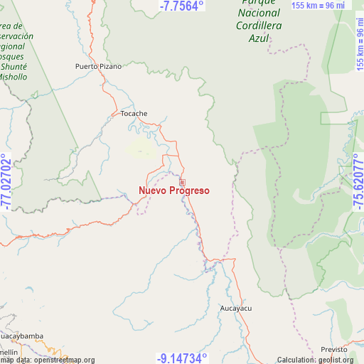
Nuevo Progreso GPS coordinates[2]
8° 27' 9" South, 76° 19' 26.004" West
| Map corner | latitude | longitude |
|---|---|---|
| Upper-left | -7.7564°, | -77.02702° |
| Center: | -8.4525°, | -76.32389° |
| Lower-right: | -9.14734°, | -75.62077° |
| Map W x H: | 154.7×154.7 km | = 96.1×96.1mi |
| max Lat: | -0.96667° ⇑28.8% North |
| Nuevo Progreso: | -8.4525° |
| min Lat: | ⇓71.2% South -18.01465° |
| min Long | Nuevo Progreso | max Long |
| -81.30472° | -76.32389° | -69.04167° |
| W 43.1%⇐ | ⇒56.9% E |
Elevation
Elevation of Nuevo Progreso is 503 m = 1650 ft, and this is 1815.7 m = 5957 ft below average elevation for this country.
| Max E: |
5022 m = 16476 ft | 77.8% |
| Avg. | 2318.7 m = 7607 ft | |
| Nuevo Progreso | 503 m = 1650 ft | |
Min E: |
1 m = 3 ft | 22.2% |
See also: Peru elevation on elevation.city.
Geographical zone
Nuevo Progreso is located in South Torrid zone (between Equator and Tropic of Capricorn). Distance of Equator is 939.8 km =584 mi to North.| Distance of | km | miles | from Nuevo Progreso |
|---|---|---|---|
| Equator | 939.8 | 584 | to North |
| Tropic Capricorn | 1666.1 | 1035.3 | to South |
| Antarctic Circle | 6461.3 | 4014.9 | to South |
| South Pole | 9067.2 | 5634.1 | to South |


Nearby cities:
15 places around Nuevo Progreso: (largest is in red/bold)
• Aczo
106.7 km =66.3 mi,  223°
223°
• Arancay
92.7 km =57.6 mi,  210°
210°
• Aucayacu
58.1 km =36.1 mi,  156°
156°
• Chingas
104.3 km =64.8 mi, 224°
• Cochabamba
91 km =56.5 mi, 218°
• Huacaybamba
95 km =59 mi,  226°
226°
• Huacchis
97.5 km =60.6 mi, 211°
• Huacrachuco
86.3 km =53.6 mi,  255°
255°
• Huancaspata
107.2 km =66.6 mi,  269°
269°
• Paucas
100.2 km =62.3 mi, 219°
• Rapayan
96.2 km =59.8 mi, 209°
• Tingo María
100.4 km =62.4 mi, 158°
• Tocache
36.5 km =22.7 mi,  323°
323°
• Uchiza
15.4 km =9.6 mi, 267°
• Uco
105.3 km =65.4 mi, 219°
Sources, notices
• [Note1] Compared only with cities in Peru existing in our database
• [Src1] Map data: © OpenStreetMap contributors (CC-BY-SA)
• [Src2] Other city data from geonames.org with taken over terms of usage.
• [Src3] Geographical zone / Annual Mean Temperature by Robert A. Rohde @ Wikipedia
