Jepelacio geodata
Jepelacio (San Martín) is a seat of a third-order administrative division; located in Peru in America/Lima (GMT-5) time zone. With population of 7,150 people, there are 184 cities with bigger population in this country. Compared to other cities in Peru, 88.9% of cities are located further ↓South; 66.8% of cities are located further →East and 71.7% of cities have higher elevation than Jepelacio. Note1


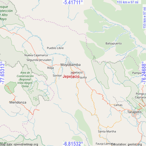
Jepelacio GPS coordinates[2]
6° 7' 0.012" South, 76° 57' 0" West
| Map corner | latitude | longitude |
|---|---|---|
| Upper-left | -5.41711°, | -77.65313° |
| Center: | -6.11667°, | -76.95° |
| Lower-right: | -6.81532°, | -76.24688° |
| Map W x H: | 155.5×155.5 km | = 96.6×96.6mi |
| max Lat: | -0.96667° ⇑11.1% North |
| Jepelacio: | -6.11667° |
| min Lat: | ⇓88.9% South -18.01465° |
| min Long | Jepelacio | max Long |
| -81.30472° | -76.95° | -69.04167° |
| W 33.2%⇐ | ⇒66.8% E |
Elevation
Elevation of Jepelacio is 1137 m = 3730 ft, and this is 1181.7 m = 3877 ft below average elevation for this country.
| Max E: |
5022 m = 16476 ft | 71.7% |
| Avg. | 2318.7 m = 7607 ft | |
| Jepelacio | 1137 m = 3730 ft | |
Min E: |
1 m = 3 ft | 28.3% |
See also: Peru elevation on elevation.city.
Geographical zone
Jepelacio is located in South Torrid zone (between Equator and Tropic of Capricorn). Distance of Equator is 680.1 km =422.6 mi to North.| Distance of | km | miles | from Jepelacio |
|---|---|---|---|
| Equator | 680.1 | 422.6 | to North |
| Tropic Capricorn | 1925.8 | 1196.6 | to South |
| Antarctic Circle | 6721.1 | 4176.3 | to South |
| South Pole | 9327 | 5795.5 | to South |


Nearby cities:
15 places around Jepelacio: (largest is in red/bold)
• Bajo Naranjillo
58.4 km =36.3 mi,  304°
304°
• Calzada
15.9 km =9.9 mi,  306°
306°
• Habana
16 km =9.9 mi,  284°
284°
• Lamas
56.9 km =35.4 mi,  125°
125°
• Moyobamba
9.5 km =5.9 mi,  345°
345°
• Nueva Cajamarca
44.2 km =27.5 mi, 296°
• Posic
26.2 km =16.3 mi, 295°
• Rioja
24.8 km =15.4 mi,  285°
285°
• Roque
35.6 km =22.1 mi,  152°
152°
• Shatoja
52.4 km =32.6 mi, 150°
• Soritor
17.2 km =10.7 mi,  261°
261°
• Tabalosos
39.3 km =24.4 mi, 131°
• Vista Alegre
38.9 km =24.2 mi, 264°
• Yorongos
21.6 km =13.4 mi, 263°
• Yuracyacu
36.9 km =22.9 mi, 303°
Sources, notices
• [Note1] Compared only with cities in Peru existing in our database
• [Src1] Map data: © OpenStreetMap contributors (CC-BY-SA)
• [Src2] Other city data from geonames.org with taken over terms of usage.
• [Src3] Geographical zone / Annual Mean Temperature by Robert A. Rohde @ Wikipedia
