Pelejo geodata
Pelejo (San Martín) is a seat of a third-order administrative division; located in Peru in America/Lima (GMT-5) time zone. In our database, there are 305 cities with bigger population. Compared to other cities in Peru, 88.3% of cities are located further ↓South; 51.5% of cities are located further →East and 87.3% of cities have higher elevation than Pelejo. Note1
Administrative division(s):
- Level 1: San Martín
- Level 2: Provincia de San Martín
- Level 3: El Porvenir


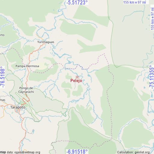
Pelejo GPS coordinates[2]
6° 13' 0.012" South, 75° 49' 0.012" West
| Map corner | latitude | longitude |
|---|---|---|
| Upper-left | -5.51723°, | -76.5198° |
| Center: | -6.21667°, | -75.81667° |
| Lower-right: | -6.91518°, | -75.11355° |
| Map W x H: | 155.4×155.4 km | = 96.6×96.6mi |
| max Lat: | -0.96667° ⇑11.7% North |
| Pelejo: | -6.21667° |
| min Lat: | ⇓88.3% South -18.01465° |
| min Long | Pelejo | max Long |
| -81.30472° | -75.81667° | -69.04167° |
| W 48.5%⇐ | ⇒51.5% E |
Elevation
Elevation of Pelejo is 143 m = 469 ft, and this is 2175.7 m = 7138 ft below average elevation for this country.
| Max E: |
5022 m = 16476 ft | 87.3% |
| Avg. | 2318.7 m = 7607 ft | |
| Pelejo | 143 m = 469 ft | |
Min E: |
1 m = 3 ft | 12.7% |
See also: Peru elevation on elevation.city.
Geographical zone
Pelejo is located in South Torrid zone (between Equator and Tropic of Capricorn). Distance of Equator is 691.2 km =429.5 mi to North.| Distance of | km | miles | from Pelejo |
|---|---|---|---|
| Equator | 691.2 | 429.5 | to North |
| Tropic Capricorn | 1914.7 | 1189.7 | to South |
| Antarctic Circle | 6709.9 | 4169.3 | to South |
| South Pole | 9315.8 | 5788.6 | to South |


Nearby cities:
15 places around Pelejo: (largest is in red/bold)
• Barranquita
22.8 km =14.2 mi,  255°
255°
• Chazuta
53 km =32.9 mi,  221°
221°
• Cuñumbuqui
80.3 km =49.9 mi,  245°
245°
• Juan Guerra
69.8 km =43.4 mi,  234°
234°
• Navarro
14.9 km =9.3 mi,  150°
150°
• Pilluana
81.4 km =50.6 mi, 220°
• San Antonio
61.3 km =38.1 mi, 254°
• Santa Cruz
74.1 km =46 mi,  1°
1°
• Sauce
68.7 km =42.7 mi, 219°
• Shapaja
63.7 km =39.6 mi, 230°
• Shucushuyacu
22.5 km =14 mi,  350°
350°
• Tarapoto
68.4 km =42.5 mi,  242°
242°
• Tres Unidos
79.9 km =49.6 mi,  214°
214°
• Utcurarca
71.8 km =44.6 mi, 226°
• Yurimaguas
48.7 km =30.3 mi,  316°
316°
Sources, notices
• [Note1] Compared only with cities in Peru existing in our database
• [Src1] Map data: © OpenStreetMap contributors (CC-BY-SA)
• [Src2] Other city data from geonames.org with taken over terms of usage.
• [Src3] Geographical zone / Annual Mean Temperature by Robert A. Rohde @ Wikipedia
