Shucushuyacu geodata
Shucushuyacu (Loreto) is a seat of a third-order administrative division; located in Peru in America/Lima (GMT-5) time zone. In our database, there are 305 cities with bigger population. Compared to other cities in Peru, 90.1% of cities are located further ↓South; 51.8% of cities are located further →East and 85.3% of cities have higher elevation than Shucushuyacu. Note1
Administrative division(s):
- Level 1: Loreto
- Level 2: Provincia de Alto Amazonas
- Level 3: Teniente Cesar Lopez Rojas


Shucushuyacu GPS coordinates[2]
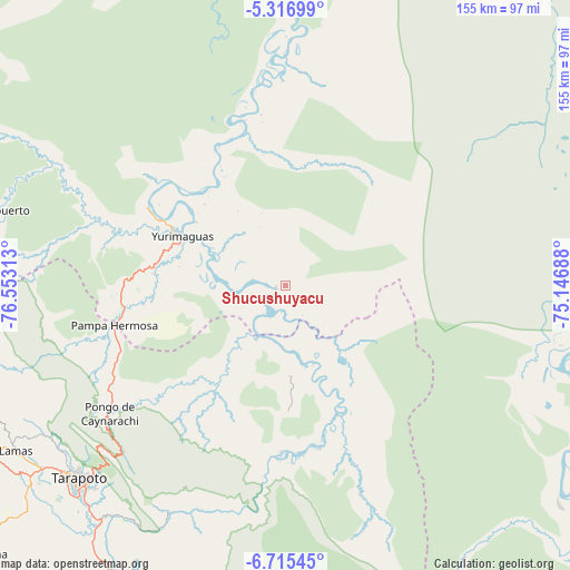
6° 1' 0.012" South, 75° 51' 0" West
| Map corner | latitude | longitude |
|---|---|---|
| Upper-left | -5.31699°, | -76.55313° |
| Center: | -6.01667°, | -75.85° |
| Lower-right: | -6.71545°, | -75.14688° |
| Map W x H: | 155.5×155.5 km | = 96.6×96.6mi |
| max Lat: | -0.96667° ⇑9.9% North |
| Shucushuyacu: | -6.01667° |
| min Lat: | ⇓90.1% South -18.01465° |
| min Long | Shucushuyacu | max Long |
| -81.30472° | -75.85° | -69.04167° |
| W 48.2%⇐ | ⇒51.8% E |
Elevation
Elevation of Shucushuyacu is 172 m = 564 ft, and this is 2146.7 m = 7043 ft below average elevation for this country.
| Max E: |
5022 m = 16476 ft | 85.3% |
| Avg. | 2318.7 m = 7607 ft | |
| Shucushuyacu | 172 m = 564 ft | |
Min E: |
1 m = 3 ft | 14.7% |
See also: Peru elevation on elevation.city.
Geographical zone
Shucushuyacu is located in South Torrid zone (between Equator and Tropic of Capricorn). Distance of Equator is 669 km =415.7 mi to North.| Distance of | km | miles | from Shucushuyacu |
|---|---|---|---|
| Equator | 669 | 415.7 | to North |
| Tropic Capricorn | 1936.9 | 1203.5 | to South |
| Antarctic Circle | 6732.2 | 4183.2 | to South |
| South Pole | 9338.1 | 5802.4 | to South |


Nearby cities:
15 places around Shucushuyacu: (largest is in red/bold)
• Barranquita
33.3 km =20.7 mi,  213°
213°
• Chazuta
69.3 km =43.1 mi, 207°
• Cuñumbuqui
88.7 km =55.1 mi,  231°
231°
• Juan Guerra
82.3 km =51.1 mi,  220°
220°
• Lagunas
89.9 km =55.9 mi,  12°
12°
• Lamas
87.7 km =54.5 mi,  239°
239°
• Navarro
36.9 km =22.9 mi,  162°
162°
• Pelejo
22.5 km =14 mi,  170°
170°
• San Antonio
67.6 km =42 mi, 234°
• Santa Cruz
52.2 km =32.4 mi, 6°
• Sauce
85.2 km =52.9 mi, 208°
• Shapaja
77.5 km =48.2 mi, 216°
• Tarapoto
78.4 km =48.7 mi, 226°
• Utcurarca
86.6 km =53.8 mi, 213°
• Yurimaguas
32.7 km =20.3 mi,  292°
292°
Sources, notices
• [Note1] Compared only with cities in Peru existing in our database
• [Src1] Map data: © OpenStreetMap contributors (CC-BY-SA)
• [Src2] Other city data from geonames.org with taken over terms of usage.
• [Src3] Geographical zone / Annual Mean Temperature by Robert A. Rohde @ Wikipedia
