Lobitos geodata
Lobitos (Piura) is a seat of a third-order administrative division; located in Peru in America/Lima (GMT-5) time zone. In our database, there are 305 cities with bigger population. Compared to other cities in Peru, 98% of cities are located further ↓South; 99.9% of cities are located further →East and 100% of cities have higher elevation than Lobitos. Note1


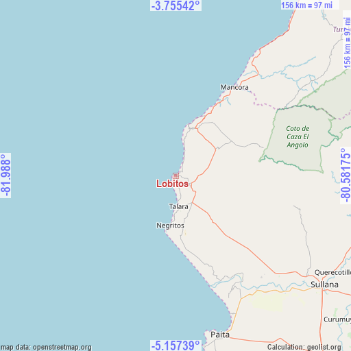
Lobitos GPS coordinates[2]
4° 27' 24.264" South, 81° 17' 5.532" West
| Map corner | latitude | longitude |
|---|---|---|
| Upper-left | -3.75542°, | -81.988° |
| Center: | -4.45674°, | -81.28487° |
| Lower-right: | -5.15739°, | -80.58175° |
| Map W x H: | 155.9×155.9 km | = 96.9×96.9mi |
| max Lat: | -0.96667° ⇑2% North |
| Lobitos: | -4.45674° |
| min Lat: | ⇓98% South -18.01465° |
| min Long | Lobitos | max Long |
| -81.30472° | -81.28487° | -69.04167° |
| W 0.1%⇐ | ⇒99.9% E |
Elevation
Elevation of Lobitos is 1 m = 3 ft, and this is 2317.7 m = 7604 ft below average elevation for this country.
| Max E: |
5022 m = 16476 ft | 100% |
| Avg. | 2318.7 m = 7607 ft | |
| Lobitos | 1 m = 3 ft | |
Min E: |
1 m = 3 ft | 0% |
See also: Peru elevation on elevation.city.
Geographical zone
Lobitos is located in South Torrid zone (between Equator and Tropic of Capricorn). Distance of Equator is 495.5 km =307.9 mi to North.| Distance of | km | miles | from Lobitos |
|---|---|---|---|
| Equator | 495.5 | 307.9 | to North |
| Tropic Capricorn | 2110.4 | 1311.3 | to South |
| Antarctic Circle | 6905.6 | 4290.9 | to South |
| South Pole | 9511.5 | 5910.2 | to South |


Nearby cities:
15 places around Lobitos: (largest is in red/bold)
• Amotape
55.9 km =34.7 mi,  147°
147°
• Arenal
55.3 km =34.4 mi, 148°
• Cancas
68.3 km =42.4 mi,  33°
33°
• El Alto
22.2 km =13.8 mi,  19°
19°
• La Breita
49.5 km =30.8 mi,  63°
63°
• La Huaca
62.1 km =38.6 mi,  144°
144°
• Los Organos
35.7 km =22.2 mi, 29°
• Máncora
46.9 km =29.1 mi, 34°
• Negritos
22 km =13.7 mi,  185°
185°
• Paita
72.8 km =45.2 mi,  164°
164°
• Salinera Colán
68.5 km =42.6 mi, 159°
• San Jacinto
62.4 km =38.8 mi,  133°
133°
• Sojo
71.7 km =44.6 mi, 133°
• Talara
13.5 km =8.4 mi,  173°
173°
• Tamarindo
58.1 km =36.1 mi, 143°
Sources, notices
• [Note1] Compared only with cities in Peru existing in our database
• [Src1] Map data: © OpenStreetMap contributors (CC-BY-SA)
• [Src2] Other city data from geonames.org with taken over terms of usage.
• [Src3] Geographical zone / Annual Mean Temperature by Robert A. Rohde @ Wikipedia
