Naranjos geodata
Naranjos (San Martín) is a seat of a third-order administrative division; located in Peru in America/Lima (GMT-5) time zone. In our database, there are 305 cities with bigger population. Compared to other cities in Peru, 91.8% of cities are located further ↓South; 73.1% of cities are located further →East and 72.8% of cities have higher elevation than Naranjos. Note1


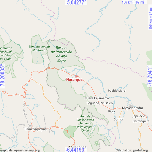
Naranjos GPS coordinates[2]
5° 44' 34.008" South, 77° 29' 49.992" West
| Map corner | latitude | longitude |
|---|---|---|
| Upper-left | -5.04277°, | -78.20035° |
| Center: | -5.74278°, | -77.49722° |
| Lower-right: | -6.44193°, | -76.7941° |
| Map W x H: | 155.6×155.6 km | = 96.7×96.7mi |
| max Lat: | -0.96667° ⇑8.2% North |
| Naranjos: | -5.74278° |
| min Lat: | ⇓91.8% South -18.01465° |
| min Long | Naranjos | max Long |
| -81.30472° | -77.49722° | -69.04167° |
| W 26.9%⇐ | ⇒73.1% E |
Elevation
Elevation of Naranjos is 974 m = 3196 ft, and this is 1344.7 m = 4412 ft below average elevation for this country.
| Max E: |
5022 m = 16476 ft | 72.8% |
| Avg. | 2318.7 m = 7607 ft | |
| Naranjos | 974 m = 3196 ft | |
Min E: |
1 m = 3 ft | 27.2% |
See also: Peru elevation on elevation.city.
Geographical zone
Naranjos is located in South Torrid zone (between Equator and Tropic of Capricorn). Distance of Equator is 638.5 km =396.7 mi to North.| Distance of | km | miles | from Naranjos |
|---|---|---|---|
| Equator | 638.5 | 396.7 | to North |
| Tropic Capricorn | 1967.4 | 1222.5 | to South |
| Antarctic Circle | 6762.6 | 4202.1 | to South |
| South Pole | 9368.5 | 5821.3 | to South |


Nearby cities:
15 places around Naranjos: (largest is in red/bold)
• Bajo Naranjillo
15 km =9.3 mi,  122°
122°
• Calzada
57.5 km =35.7 mi, 124°
• Chisquilla
30.4 km =18.9 mi,  239°
239°
• Cuispes
52 km =32.3 mi,  248°
248°
• Granada
42.1 km =26.2 mi,  199°
199°
• Habana
58.7 km =36.5 mi,  129°
129°
• Nueva Cajamarca
30.4 km =18.9 mi,  136°
136°
• Olleros
37.8 km =23.5 mi,  205°
205°
• Posic
47.6 km =29.6 mi, 129°
• Quinjalca
43.7 km =27.2 mi, 207°
• Rioja
50.6 km =31.4 mi, 133°
• San Carlos
54.3 km =33.7 mi, 242°
• Vista Alegre
50.4 km =31.3 mi,  154°
154°
• Yambrasbamba
44.6 km =27.7 mi,  268°
268°
• Yuracyacu
36.5 km =22.7 mi, 125°
Sources, notices
• [Note1] Compared only with cities in Peru existing in our database
• [Src1] Map data: © OpenStreetMap contributors (CC-BY-SA)
• [Src2] Other city data from geonames.org with taken over terms of usage.
• [Src3] Geographical zone / Annual Mean Temperature by Robert A. Rohde @ Wikipedia
