Tocota geodata
Tocota (Arequipa) is a seat of a third-order administrative division; located in Peru in America/Lima (GMT-5) time zone. In our database, there are 305 cities with bigger population. Compared to other cities in Peru, 91.4% of cities are located further ↑North; 65.3% of cities are located further ←West and 73% of cities have higher elevation than Tocota. Note1


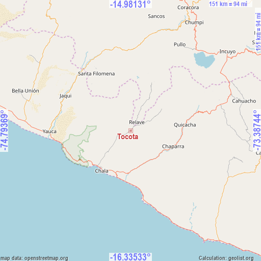
Tocota GPS coordinates[2]
15° 39' 33.984" South, 74° 5' 26.016" West
| Map corner | latitude | longitude |
|---|---|---|
| Upper-left | -14.98131°, | -74.79369° |
| Center: | -15.65944°, | -74.09056° |
| Lower-right: | -16.33533°, | -73.38744° |
| Map W x H: | 150.6×150.6 km | = 93.6×93.6mi |
| max Lat: | -0.96667° ⇑91.4% North |
| Tocota: | -15.65944° |
| min Lat: | ⇓8.6% South -18.01465° |
| min Long | Tocota | max Long |
| -81.30472° | -74.09056° | -69.04167° |
| W 65.3%⇐ | ⇒34.7% E |
Elevation
Elevation of Tocota is 963 m = 3159 ft, and this is 1355.7 m = 4448 ft below average elevation for this country.
| Max E: |
5022 m = 16476 ft | 73% |
| Avg. | 2318.7 m = 7607 ft | |
| Tocota | 963 m = 3159 ft | |
Min E: |
1 m = 3 ft | 27% |
See also: Peru elevation on elevation.city.
Geographical zone
Tocota is located in South Torrid zone (between Equator and Tropic of Capricorn). Distance of this Southern Tropic circle is 864.8 km =537.4 mi to South.| Distance of | km | miles | from Tocota |
|---|---|---|---|
| Equator | 1741.2 | 1081.9 | to North |
| Tropic Capricorn | 864.8 | 537.4 | to South |
| Antarctic Circle | 5660 | 3517 | to South |
| South Pole | 8265.9 | 5136.2 | to South |


Nearby cities:
15 places around Tocota: (largest is in red/bold)
• Acarí
61.8 km =38.4 mi,  295°
295°
• Achanizo
21 km =13 mi,  140°
140°
• Atico
79 km =49.1 mi, 140°
• Atiquipa
32.9 km =20.4 mi,  242°
242°
• Cahuacho
67.7 km =42.1 mi,  75°
75°
• Chala
28.4 km =17.6 mi,  216°
216°
• Chaviña
80.1 km =49.8 mi,  20°
20°
• Chumpi
71.2 km =44.2 mi,  29°
29°
• Coracora
77 km =47.8 mi, 25°
• Incuyo
70.9 km =44.1 mi,  50°
50°
• Pausa
90.3 km =56.1 mi,  62°
62°
• Pullo
57.3 km =35.6 mi, 30°
• Quicacha
31.5 km =19.6 mi, 83°
• Quilcata
82.2 km =51.1 mi, 56°
• Yauca
46.8 km =29.1 mi,  269°
269°
Sources, notices
• [Note1] Compared only with cities in Peru existing in our database
• [Src1] Map data: © OpenStreetMap contributors (CC-BY-SA)
• [Src2] Other city data from geonames.org with taken over terms of usage.
• [Src3] Geographical zone / Annual Mean Temperature by Robert A. Rohde @ Wikipedia
