Queropalca geodata
Queropalca (Huanuco) is a seat of a third-order administrative division; located in Peru in America/Lima (GMT-5) time zone. In our database, there are 305 cities with bigger population. Compared to other cities in Peru, 59.6% of cities are located further ↓South; 64.9% of cities are located further →East and 89.2% of cities have lower elevation than Queropalca. Note1


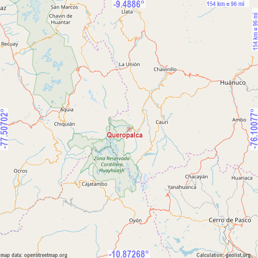
Queropalca GPS coordinates[2]
10° 10' 53.004" South, 76° 48' 14.004" West
| Map corner | latitude | longitude |
|---|---|---|
| Upper-left | -9.4886°, | -77.50702° |
| Center: | -10.18139°, | -76.80389° |
| Lower-right: | -10.87268°, | -76.10077° |
| Map W x H: | 153.9×153.9 km | = 95.6×95.6mi |
| max Lat: | -0.96667° ⇑40.4% North |
| Queropalca: | -10.18139° |
| min Lat: | ⇓59.6% South -18.01465° |
| min Long | Queropalca | max Long |
| -81.30472° | -76.80389° | -69.04167° |
| W 35.1%⇐ | ⇒64.9% E |
Elevation
Elevation of Queropalca is 3823 m = 12543 ft, and this is 1504.3 m = 4935 ft above average elevation for this country.
| Max E: |
5022 m = 16476 ft | 10.8% |
| Queropalca | 3823 m 12543 ft | |
| Avg. | 2318.7 m = 7607 ft | |
Min E: |
1 m = 3 ft | 89.2% |
See also: Peru elevation on elevation.city.
Geographical zone
Queropalca is located in South Torrid zone (between Equator and Tropic of Capricorn). Distance of Equator is 1132.1 km =703.5 mi to North.| Distance of | km | miles | from Queropalca |
|---|---|---|---|
| Equator | 1132.1 | 703.5 | to North |
| Tropic Capricorn | 1473.9 | 915.8 | to South |
| Antarctic Circle | 6269.1 | 3895.4 | to South |
| South Pole | 8875 | 5514.7 | to South |


Nearby cities:
15 places around Queropalca: (largest is in red/bold)
• Aquia
39.1 km =24.3 mi,  287°
287°
• Baños
13.9 km =8.6 mi,  32°
32°
• Cahuac
41.2 km =25.6 mi, 27°
• Cauri
20.1 km =12.5 mi,  77°
77°
• Copa
37.9 km =23.5 mi,  232°
232°
• Huallanca
34.9 km =21.7 mi,  334°
334°
• Huasta
39.2 km =24.4 mi,  279°
279°
• Jivia
22.2 km =13.8 mi,  37°
37°
• La Unión
39.4 km =24.5 mi,  0°
0°
• Llaclla
39.6 km =24.6 mi,  250°
250°
• Mangas
39 km =24.2 mi,  236°
236°
• Margos
36.5 km =22.7 mi,  57°
57°
• Rondos
25.4 km =15.8 mi, 29°
• San Miguel de Cauri
20.4 km =12.7 mi, 76°
• Yanacancha
18.6 km =11.6 mi,  110°
110°
Sources, notices
• [Note1] Compared only with cities in Peru existing in our database
• [Src1] Map data: © OpenStreetMap contributors (CC-BY-SA)
• [Src2] Other city data from geonames.org with taken over terms of usage.
• [Src3] Geographical zone / Annual Mean Temperature by Robert A. Rohde @ Wikipedia
