Huaros geodata
Huaros (Lima region) is a seat of a third-order administrative division; located in Peru in America/Lima (GMT-5) time zone. In our database, there are 305 cities with bigger population. Compared to other cities in Peru, 53% of cities are located further ↓South; 60.2% of cities are located further →East and 82.8% of cities have lower elevation than Huaros. Note1


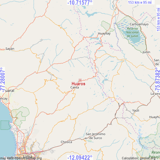
Huaros GPS coordinates[2]
11° 24' 20.988" South, 76° 34' 36.984" West
| Map corner | latitude | longitude |
|---|---|---|
| Upper-left | -10.71577°, | -77.28007° |
| Center: | -11.40583°, | -76.57694° |
| Lower-right: | -12.09422°, | -75.87382° |
| Map W x H: | 153.3×153.3 km | = 95.3×95.3mi |
| max Lat: | -0.96667° ⇑47% North |
| Huaros: | -11.40583° |
| min Lat: | ⇓53% South -18.01465° |
| min Long | Huaros | max Long |
| -81.30472° | -76.57694° | -69.04167° |
| W 39.8%⇐ | ⇒60.2% E |
Elevation
Elevation of Huaros is 3586 m = 11765 ft, and this is 1267.3 m = 4158 ft above average elevation for this country.
| Max E: |
5022 m = 16476 ft | 17.2% |
| Huaros | 3586 m 11765 ft | |
| Avg. | 2318.7 m = 7607 ft | |
Min E: |
1 m = 3 ft | 82.8% |
See also: Peru elevation on elevation.city.
Geographical zone
Huaros is located in South Torrid zone (between Equator and Tropic of Capricorn). Distance of Equator is 1268.2 km =788 mi to North.| Distance of | km | miles | from Huaros |
|---|---|---|---|
| Equator | 1268.2 | 788 | to North |
| Tropic Capricorn | 1337.7 | 831.2 | to South |
| Antarctic Circle | 6133 | 3810.9 | to South |
| South Pole | 8738.9 | 5430.1 | to South |


Nearby cities:
15 places around Huaros: (largest is in red/bold)
• Acos
30.4 km =18.9 mi,  298°
298°
• Arahuay
26.1 km =16.2 mi,  202°
202°
• Canta
8.5 km =5.3 mi,  217°
217°
• Carac
32.5 km =20.2 mi,  317°
317°
• Carampoma
29.2 km =18.1 mi,  166°
166°
• Huamantanga
21.4 km =13.3 mi,  241°
241°
• Huanza
29 km =18 mi,  163°
163°
• Lachaqui
17.2 km =10.7 mi, 197°
• Lampian
34.2 km =21.3 mi, 303°
• Laraos
29.1 km =18.1 mi, 171°
• Marcapomacocha
26.2 km =16.3 mi,  90°
90°
• Pacaraos
25.6 km =15.9 mi,  342°
342°
• Pirca
20.9 km =13 mi, 335°
• San Buenaventura
13.1 km =8.1 mi,  225°
225°
• Sumbilca
26.5 km =16.5 mi,  269°
269°
Sources, notices
• [Note1] Compared only with cities in Peru existing in our database
• [Src1] Map data: © OpenStreetMap contributors (CC-BY-SA)
• [Src2] Other city data from geonames.org with taken over terms of usage.
• [Src3] Geographical zone / Annual Mean Temperature by Robert A. Rohde @ Wikipedia
