Carac geodata
Carac (Lima region) is a seat of a third-order administrative division; located in Peru in America/Lima (GMT-5) time zone. In our database, there are 305 cities with bigger population. Compared to other cities in Peru, 54.3% of cities are located further ↓South; 64.2% of cities are located further →East and 56.4% of cities have higher elevation than Carac. Note1
Administrative division(s):
- Level 1: Lima region
- Level 2: Provincia de Huaral
- Level 3: Veintisiete De Noviembre


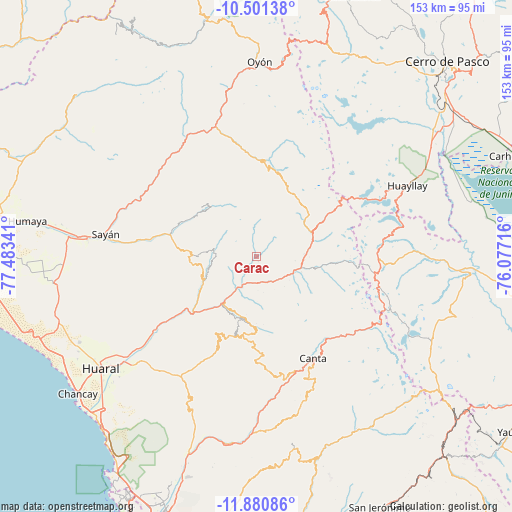
Carac GPS coordinates[2]
11° 11' 30.984" South, 76° 46' 49.008" West
| Map corner | latitude | longitude |
|---|---|---|
| Upper-left | -10.50138°, | -77.48341° |
| Center: | -11.19194°, | -76.78028° |
| Lower-right: | -11.88086°, | -76.07716° |
| Map W x H: | 153.4×153.4 km | = 95.3×95.3mi |
| max Lat: | -0.96667° ⇑45.7% North |
| Carac: | -11.19194° |
| min Lat: | ⇓54.3% South -18.01465° |
| min Long | Carac | max Long |
| -81.30472° | -76.78028° | -69.04167° |
| W 35.8%⇐ | ⇒64.2% E |
Elevation
Elevation of Carac is 2615 m = 8579 ft, and this is 296.3 m = 972 ft above average elevation for this country.
| Max E: |
5022 m = 16476 ft | 56.4% |
| Carac | 2615 m 8579 ft | |
| Avg. | 2318.7 m = 7607 ft | |
Min E: |
1 m = 3 ft | 43.6% |
See also: Peru elevation on elevation.city.
Geographical zone
Carac is located in South Torrid zone (between Equator and Tropic of Capricorn). Distance of Equator is 1244.4 km =773.2 mi to North.| Distance of | km | miles | from Carac |
|---|---|---|---|
| Equator | 1244.4 | 773.2 | to North |
| Tropic Capricorn | 1361.5 | 846 | to South |
| Antarctic Circle | 6156.7 | 3825.6 | to South |
| South Pole | 8762.6 | 5444.8 | to South |


Nearby cities:
15 places around Carac: (largest is in red/bold)
• Acos
10.1 km =6.3 mi,  205°
205°
• Canta
35 km =21.7 mi,  150°
150°
• Huamantanga
34.3 km =21.3 mi,  174°
174°
• Huaros
32.5 km =20.2 mi,  137°
137°
• Ihuari
18.7 km =11.6 mi,  270°
270°
• Jucul
27.3 km =17 mi,  8°
8°
• Lachaqui
43.7 km =27.2 mi,  156°
156°
• Lampian
8.2 km =5.1 mi,  231°
231°
• Maray
29.1 km =18.1 mi,  348°
348°
• Pacaraos
14.5 km =9 mi,  87°
87°
• Paccho
30.9 km =19.2 mi,  327°
327°
• Pirca
14.4 km =8.9 mi,  109°
109°
• San Buenaventura
35.4 km =22 mi, 158°
• Santa Cruz
22 km =13.7 mi,  311°
311°
• Sumbilca
24.4 km =15.2 mi,  190°
190°
Sources, notices
• [Note1] Compared only with cities in Peru existing in our database
• [Src1] Map data: © OpenStreetMap contributors (CC-BY-SA)
• [Src2] Other city data from geonames.org with taken over terms of usage.
• [Src3] Geographical zone / Annual Mean Temperature by Robert A. Rohde @ Wikipedia
