Andamarca geodata
Andamarca (Junin) is a seat of a third-order administrative division; located in Peru in America/Lima (GMT-5) time zone. In our database, there are 305 cities with bigger population. Compared to other cities in Peru, 50.8% of cities are located further ↓South; 60% of cities are located further ←West and 59% of cities have higher elevation than Andamarca. Note1


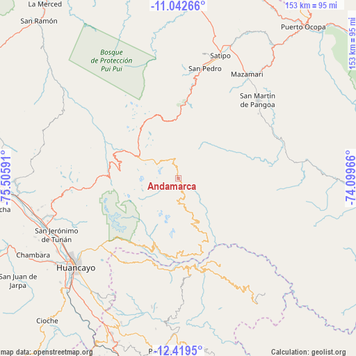
Andamarca GPS coordinates[2]
11° 43' 54.984" South, 74° 48' 10.008" West
| Map corner | latitude | longitude |
|---|---|---|
| Upper-left | -11.04266°, | -75.50591° |
| Center: | -11.73194°, | -74.80278° |
| Lower-right: | -12.4195°, | -74.09966° |
| Map W x H: | 153.1×153.1 km | = 95.1×95.1mi |
| max Lat: | -0.96667° ⇑49.2% North |
| Andamarca: | -11.73194° |
| min Lat: | ⇓50.8% South -18.01465° |
| min Long | Andamarca | max Long |
| -81.30472° | -74.80278° | -69.04167° |
| W 60%⇐ | ⇒40% E |
Elevation
Elevation of Andamarca is 2485 m = 8153 ft, and this is 166.3 m = 546 ft above average elevation for this country.
| Max E: |
5022 m = 16476 ft | 59% |
| Andamarca | 2485 m 8153 ft | |
| Avg. | 2318.7 m = 7607 ft | |
Min E: |
1 m = 3 ft | 41% |
See also: Peru elevation on elevation.city.
Geographical zone
Andamarca is located in South Torrid zone (between Equator and Tropic of Capricorn). Distance of this Southern Tropic circle is 1301.4 km =808.7 mi to South.| Distance of | km | miles | from Andamarca |
|---|---|---|---|
| Equator | 1304.5 | 810.6 | to North |
| Tropic Capricorn | 1301.4 | 808.7 | to South |
| Antarctic Circle | 6096.7 | 3788.3 | to South |
| South Pole | 8702.6 | 5407.5 | to South |


Nearby cities:
15 places around Andamarca: (largest is in red/bold)
• Cochas
33.5 km =20.8 mi,  284°
284°
• Comas
30.4 km =18.9 mi,  273°
273°
• Coviriali
52.5 km =32.6 mi,  21°
21°
• Hualhuas
55.5 km =34.5 mi,  241°
241°
• Ingenio
53.3 km =33.1 mi,  250°
250°
• Mariposa
37.1 km =23.1 mi,  8°
8°
• Mazamari
54 km =33.6 mi,  33°
33°
• Mucllo
33.9 km =21.1 mi,  292°
292°
• Quichuay
55.4 km =34.4 mi, 251°
• Quilcas
54.6 km =33.9 mi, 245°
• Salcabamba
52.1 km =32.4 mi,  177°
177°
• San Agustin
56 km =34.8 mi, 241°
• Satipo
56.3 km =35 mi, 18°
• Saño
55.4 km =34.4 mi, 243°
• Surcubamba
46.5 km =28.9 mi,  163°
163°
Sources, notices
• [Note1] Compared only with cities in Peru existing in our database
• [Src1] Map data: © OpenStreetMap contributors (CC-BY-SA)
• [Src2] Other city data from geonames.org with taken over terms of usage.
• [Src3] Geographical zone / Annual Mean Temperature by Robert A. Rohde @ Wikipedia
