Mariposa geodata
Mariposa (Junin) is a seat of a third-order administrative division; located in Peru in America/Lima (GMT-5) time zone. In our database, there are 305 cities with bigger population. Compared to other cities in Peru, 53.1% of cities are located further ↓South; 60.2% of cities are located further ←West and 71.1% of cities have higher elevation than Mariposa. Note1


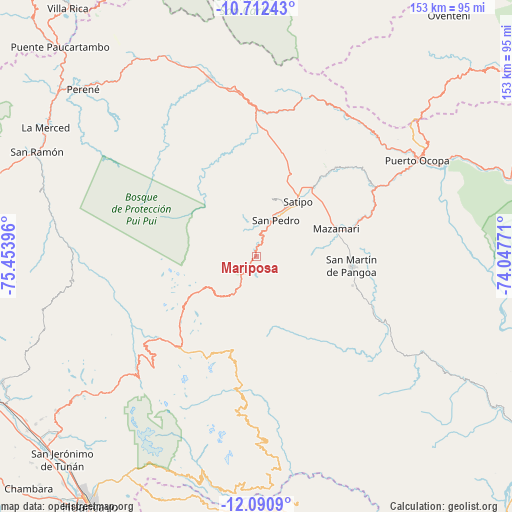
Mariposa GPS coordinates[2]
11° 24' 9" South, 74° 45' 2.988" West
| Map corner | latitude | longitude |
|---|---|---|
| Upper-left | -10.71243°, | -75.45396° |
| Center: | -11.4025°, | -74.75083° |
| Lower-right: | -12.0909°, | -74.04771° |
| Map W x H: | 153.3×153.3 km | = 95.3×95.3mi |
| max Lat: | -0.96667° ⇑46.9% North |
| Mariposa: | -11.4025° |
| min Lat: | ⇓53.1% South -18.01465° |
| min Long | Mariposa | max Long |
| -81.30472° | -74.75083° | -69.04167° |
| W 60.2%⇐ | ⇒39.8% E |
Elevation
Elevation of Mariposa is 1223 m = 4012 ft, and this is 1095.7 m = 3595 ft below average elevation for this country.
| Max E: |
5022 m = 16476 ft | 71.1% |
| Avg. | 2318.7 m = 7607 ft | |
| Mariposa | 1223 m = 4012 ft | |
Min E: |
1 m = 3 ft | 28.9% |
See also: Peru elevation on elevation.city.
Geographical zone
Mariposa is located in South Torrid zone (between Equator and Tropic of Capricorn). Distance of Equator is 1267.8 km =787.8 mi to North.| Distance of | km | miles | from Mariposa |
|---|---|---|---|
| Equator | 1267.8 | 787.8 | to North |
| Tropic Capricorn | 1338.1 | 831.5 | to South |
| Antarctic Circle | 6133.3 | 3811.1 | to South |
| South Pole | 8739.2 | 5430.3 | to South |


Nearby cities:
15 places around Mariposa: (largest is in red/bold)
• Andamarca
37.1 km =23.1 mi,  188°
188°
• Bajo Pichanaqui
54.5 km =33.9 mi,  345°
345°
• Cochas
47.5 km =29.5 mi,  233°
233°
• Comas
50.2 km =31.2 mi, 225°
• Coviriali
18.2 km =11.3 mi,  47°
47°
• Ingenio
77.9 km =48.4 mi, 225°
• La Merced
74.1 km =46 mi,  300°
300°
• Masma Chicche
80.6 km =50.1 mi,  238°
238°
• Mazamari
25.5 km =15.8 mi,  70°
70°
• Mucllo
44 km =27.3 mi, 237°
• Perené
72.5 km =45 mi,  314°
314°
• Puerto Ocopa
56.2 km =34.9 mi,  59°
59°
• Quichuay
79.6 km =49.5 mi, 227°
• San Ramón
73 km =45.4 mi, 295°
• Satipo
20.7 km =12.9 mi,  36°
36°
Sources, notices
• [Note1] Compared only with cities in Peru existing in our database
• [Src1] Map data: © OpenStreetMap contributors (CC-BY-SA)
• [Src2] Other city data from geonames.org with taken over terms of usage.
• [Src3] Geographical zone / Annual Mean Temperature by Robert A. Rohde @ Wikipedia
