Ambo geodata
Ambo (Huanuco) is a seat of a third-order administrative division; located in Peru in America/Lima (GMT-5) time zone. With population of 6,865 people, there are 188 cities with bigger population in this country. Compared to other cities in Peru, 60% of cities are located further ↓South; 55% of cities are located further →East and 64.4% of cities have higher elevation than Ambo. Note1


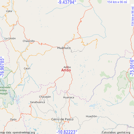
Ambo GPS coordinates[2]
10° 7' 50.988" South, 76° 12' 16.992" West
| Map corner | latitude | longitude |
|---|---|---|
| Upper-left | -9.43794°, | -76.90785° |
| Center: | -10.13083°, | -76.20472° |
| Lower-right: | -10.82223°, | -75.5016° |
| Map W x H: | 153.9×153.9 km | = 95.6×95.6mi |
| max Lat: | -0.96667° ⇑40% North |
| Ambo: | -10.13083° |
| min Lat: | ⇓60% South -18.01465° |
| min Long | Ambo | max Long |
| -81.30472° | -76.20472° | -69.04167° |
| W 45%⇐ | ⇒55% E |
Elevation
Elevation of Ambo is 2098 m = 6883 ft, and this is 220.7 m = 724 ft below average elevation for this country.
| Max E: |
5022 m = 16476 ft | 64.4% |
| Avg. | 2318.7 m = 7607 ft | |
| Ambo | 2098 m = 6883 ft | |
Min E: |
1 m = 3 ft | 35.6% |
See also: Peru elevation on elevation.city.
Geographical zone
Ambo is located in South Torrid zone (between Equator and Tropic of Capricorn). Distance of Equator is 1126.4 km =699.9 mi to North.| Distance of | km | miles | from Ambo |
|---|---|---|---|
| Equator | 1126.4 | 699.9 | to North |
| Tropic Capricorn | 1479.5 | 919.3 | to South |
| Antarctic Circle | 6274.7 | 3898.9 | to South |
| South Pole | 8880.6 | 5518.1 | to South |


Nearby cities:
15 places around Ambo: (largest is in red/bold)
• Cayhuayna
19.8 km =12.3 mi,  345°
345°
• Cayna
25.5 km =15.8 mi,  232°
232°
• Churubamba
34.8 km =21.6 mi,  12°
12°
• Colpas
27.6 km =17.1 mi,  236°
236°
• Conchamarca
10.4 km =6.5 mi, 353°
• Huacar
4.8 km =3 mi, 227°
• Huancapallac
34.9 km =21.7 mi,  318°
318°
• Huariaca
34.6 km =21.5 mi,  177°
177°
• Huánuco
22.6 km =14 mi, 349°
• Mosca
25.4 km =15.8 mi,  201°
201°
• Pallanchacra
31.8 km =19.8 mi,  186°
186°
• Panao
34.7 km =21.6 mi,  41°
41°
• Paucarbamba
20.8 km =12.9 mi, 354°
• San Rafael
23.2 km =14.4 mi,  174°
174°
• Tomay Kichwa
6 km =3.7 mi, 352°
Sources, notices
• [Note1] Compared only with cities in Peru existing in our database
• [Src1] Map data: © OpenStreetMap contributors (CC-BY-SA)
• [Src2] Other city data from geonames.org with taken over terms of usage.
• [Src3] Geographical zone / Annual Mean Temperature by Robert A. Rohde @ Wikipedia
