Huancapallac geodata
Huancapallac (Huanuco) is a seat of a third-order administrative division; located in Peru in America/Lima (GMT-5) time zone. In our database, there are 305 cities with bigger population. Compared to other cities in Peru, 61.9% of cities are located further ↓South; 58.3% of cities are located further →East and 50.1% of cities have lower elevation than Huancapallac. Note1


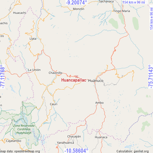
Huancapallac GPS coordinates[2]
9° 53' 38.832" South, 76° 24' 52.38" West
| Map corner | latitude | longitude |
|---|---|---|
| Upper-left | -9.20074°, | -77.11768° |
| Center: | -9.89412°, | -76.41455° |
| Lower-right: | -10.58604°, | -75.71143° |
| Map W x H: | 154×154 km | = 95.7×95.7mi |
| max Lat: | -0.96667° ⇑38.1% North |
| Huancapallac: | -9.89412° |
| min Lat: | ⇓61.9% South -18.01465° |
| min Long | Huancapallac | max Long |
| -81.30472° | -76.41455° | -69.04167° |
| W 41.7%⇐ | ⇒58.3% E |
Elevation
Elevation of Huancapallac is 2860 m = 9383 ft, and this is 541.3 m = 1776 ft above average elevation for this country.
| Max E: |
5022 m = 16476 ft | 49.9% |
| Huancapallac | 2860 m 9383 ft | |
| Avg. | 2318.7 m = 7607 ft | |
Min E: |
1 m = 3 ft | 50.1% |
See also: Peru elevation on elevation.city.
Geographical zone
Huancapallac is located in South Torrid zone (between Equator and Tropic of Capricorn). Distance of Equator is 1100.1 km =683.6 mi to North.| Distance of | km | miles | from Huancapallac |
|---|---|---|---|
| Equator | 1100.1 | 683.6 | to North |
| Tropic Capricorn | 1505.8 | 935.7 | to South |
| Antarctic Circle | 6301.1 | 3915.3 | to South |
| South Pole | 8906.9 | 5534.5 | to South |


Nearby cities:
15 places around Huancapallac: (largest is in red/bold)
• Ambo
34.9 km =21.7 mi,  138°
138°
• Cahuac
24.1 km =15 mi,  281°
281°
• Cayhuayna
19.5 km =12.1 mi,  111°
111°
• Chavinillo
21.6 km =13.4 mi, 280°
• Churubamba
31.7 km =19.7 mi,  76°
76°
• Conchamarca
27 km =16.8 mi,  126°
126°
• Huacar
35.4 km =22 mi,  146°
146°
• Huánuco
19.3 km =12 mi,  102°
102°
• Jivia
32.4 km =20.1 mi,  243°
243°
• Margos
17.2 km =10.7 mi,  223°
223°
• Obas
29.6 km =18.4 mi,  291°
291°
• Paucarbamba
21.7 km =13.5 mi, 104°
• Rondos
31.6 km =19.6 mi,  251°
251°
• San Miguel de Cauri
35.5 km =22.1 mi, 220°
• Tomay Kichwa
30.1 km =18.7 mi, 132°
Sources, notices
• [Note1] Compared only with cities in Peru existing in our database
• [Src1] Map data: © OpenStreetMap contributors (CC-BY-SA)
• [Src2] Other city data from geonames.org with taken over terms of usage.
• [Src3] Geographical zone / Annual Mean Temperature by Robert A. Rohde @ Wikipedia
