Huánuco geodata
Huánuco (Huanuco) is a seat of a first-order administrative division; located in Peru in America/Lima (GMT-5) time zone. With population of 147,959 people, there are 17 cities with bigger population in this country. Compared to other cities in Peru, 61.6% of cities are located further ↓South; 55.7% of cities are located further →East and 67% of cities have higher elevation than Huánuco. Note1


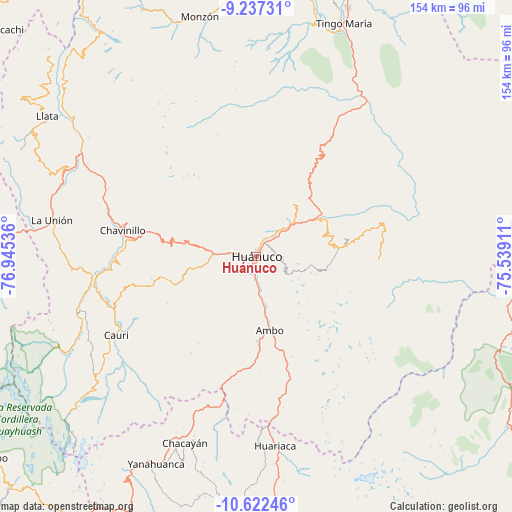
Huánuco GPS coordinates[2]
9° 55' 50.232" South, 76° 14' 32.028" West
| Map corner | latitude | longitude |
|---|---|---|
| Upper-left | -9.23731°, | -76.94536° |
| Center: | -9.93062°, | -76.24223° |
| Lower-right: | -10.62246°, | -75.53911° |
| Map W x H: | 154×154 km | = 95.7×95.7mi |
| max Lat: | -0.96667° ⇑38.4% North |
| Huánuco: | -9.93062° |
| min Lat: | ⇓61.6% South -18.01465° |
| min Long | Huánuco | max Long |
| -81.30472° | -76.24223° | -69.04167° |
| W 44.3%⇐ | ⇒55.7% E |
Elevation
Elevation of Huánuco is 1900 m = 6234 ft, and this is 418.7 m = 1374 ft below average elevation for this country.
| Max E: |
5022 m = 16476 ft | 67% |
| Avg. | 2318.7 m = 7607 ft | |
| Huánuco | 1900 m = 6234 ft | |
Min E: |
1 m = 3 ft | 33% |
See also: Huánuco elevation on elevation.city.
Geographical zone
Huánuco is located in South Torrid zone (between Equator and Tropic of Capricorn). Distance of Equator is 1104.2 km =686.1 mi to North.| Distance of | km | miles | from Huánuco |
|---|---|---|---|
| Equator | 1104.2 | 686.1 | to North |
| Tropic Capricorn | 1501.7 | 933.1 | to South |
| Antarctic Circle | 6297 | 3912.8 | to South |
| South Pole | 8902.9 | 5532 | to South |


Nearby cities:
15 places around Huánuco: (largest is in red/bold)
• Acomayo
23.6 km =14.7 mi,  52°
52°
• Ambo
22.6 km =14 mi,  169°
169°
• Cayhuayna
3.2 km =2 mi,  192°
192°
• Cayna
41.2 km =25.6 mi,  202°
202°
• Chaglla
38.4 km =23.9 mi,  75°
75°
• Chavinillo
40.9 km =25.4 mi,  281°
281°
• Churubamba
16.7 km =10.4 mi, 45°
• Colpas
42.1 km =26.2 mi,  206°
206°
• Conchamarca
12.3 km =7.6 mi, 166°
• Huacar
25.5 km =15.8 mi,  178°
178°
• Huancapallac
19.3 km =12 mi, 282°
• Margos
31.8 km =19.8 mi,  254°
254°
• Panao
27.5 km =17.1 mi, 82°
• Paucarbamba
2.6 km =1.6 mi,  126°
126°
• Tomay Kichwa
16.6 km =10.3 mi, 168°
Sources, notices
• [Note1] Compared only with cities in Peru existing in our database
• [Src1] Map data: © OpenStreetMap contributors (CC-BY-SA)
• [Src2] Other city data from geonames.org with taken over terms of usage.
• [Src3] Geographical zone / Annual Mean Temperature by Robert A. Rohde @ Wikipedia
