Uson geodata
Uson (Bicol) is a seat of a third-order administrative division; located in Philippines in Asia/Manila (GMT+8) time zone. With population of 4,395 people, there are 1540 cities with bigger population in this country. Compared to other cities in Philippines, 52.9% of cities are located further ↓South; 67.7% of cities are located further ←West and 89.7% of cities have higher elevation than Uson. Note1


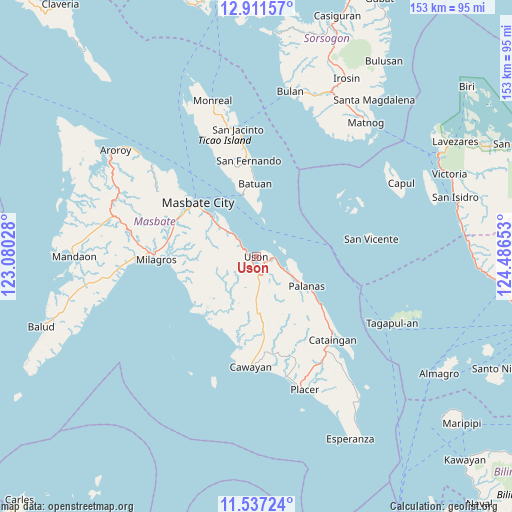
Uson GPS coordinates[2]
12° 13' 31.08" North, 123° 47' 0.24" East
| Map corner | latitude | longitude |
|---|---|---|
| Upper-left | 12.91157°, | 123.08028° |
| Center: | 12.2253°, | 123.7834° |
| Lower-right: | 11.53724°, | 124.48653° |
| Map W x H: | 152.8×152.8 km | = 94.9×94.9mi |
| max Lat: | 20.78733° ⇑47.1% North |
| Uson: | 12.2253° |
| min Lat: | ⇓52.9% South 4.65442° |
| min Long | Uson | max Long |
| 117.04868° | 123.7834° | 126.58417° |
| W 67.7%⇐ | ⇒32.3% E |
Elevation
Elevation of Uson is 7 m = 23 ft, and this is 80.9 m = 265 ft below average elevation for this country.
| Max E: |
2262 m = 7421 ft | 89.7% |
| Avg. | 87.9 m = 288 ft | |
| Uson | 7 m = 23 ft | |
Min E: |
-2 m = -7 ft | 10.3% |
See also: Philippines elevation on elevation.city.
Geographical zone
Uson is located in North Torrid zone (between Equator and Tropic of Cancer). Distance of this Northern Tropic circle is 1246.6 km =774.6 mi to North.| Distance of | km | miles | from Uson |
|---|---|---|---|
| North Pole | 8647.7 | 5373.4 | to North |
| Arctic Circle | 6041.8 | 3754.2 | to North |
| Tropic Cancer | 1246.6 | 774.6 | to North |
| Equator | 1359.3 | 844.6 | to South |


Nearby cities:
15 places around Uson: (largest is in red/bold)
• Armenia
5.3 km =3.3 mi,  305°
305°
• Balucawi
7 km =4.3 mi,  112°
112°
• Barra
23.2 km =14.4 mi,  222°
222°
• Batuan
19.3 km =12 mi,  353°
353°
• Buenavista
5.5 km =3.4 mi,  171°
171°
• Dapdap
2.2 km =1.4 mi,  239°
239°
• Dimasalang
9 km =5.6 mi, 114°
• Marintoc
9.4 km =5.8 mi,  315°
315°
• Miaga
3.9 km =2.4 mi,  69°
69°
• Mobo
18.4 km =11.4 mi, 312°
• Nabangig
22.9 km =14.2 mi,  127°
127°
• Palanas
17.4 km =10.8 mi,  120°
120°
• Peña
22.7 km =14.1 mi, 131°
• Tigbaw
22.6 km =14 mi,  247°
247°
• Umabay
14.7 km =9.1 mi, 309°
Sources, notices
• [Note1] Compared only with cities in Philippines existing in our database
• [Src1] Map data: © OpenStreetMap contributors (CC-BY-SA)
• [Src2] Other city data from geonames.org with taken over terms of usage.
• [Src3] Geographical zone / Annual Mean Temperature by Robert A. Rohde @ Wikipedia
