Nabangig geodata
Nabangig (Bicol) is a populated place; located in Philippines in Asia/Manila (GMT+8) time zone. With population of 2,973 people, there are 2561 cities with bigger population in this country. Compared to other cities in Philippines, 52.2% of cities are located further ↓South; 70.1% of cities are located further ←West and 81% of cities have lower elevation than Nabangig. Note1


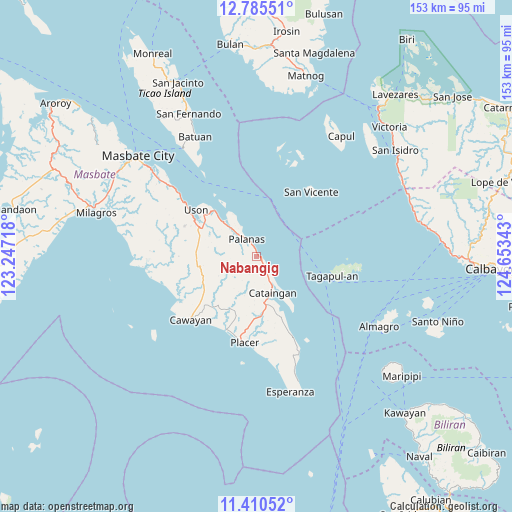
Nabangig GPS coordinates[2]
12° 5' 56.04" North, 123° 57' 1.08" East
| Map corner | latitude | longitude |
|---|---|---|
| Upper-left | 12.78551°, | 123.24718° |
| Center: | 12.0989°, | 123.9503° |
| Lower-right: | 11.41052°, | 124.65343° |
| Map W x H: | 152.9×152.9 km | = 95×95mi |
| max Lat: | 20.78733° ⇑47.8% North |
| Nabangig: | 12.0989° |
| min Lat: | ⇓52.2% South 4.65442° |
| min Long | Nabangig | max Long |
| 117.04868° | 123.9503° | 126.58417° |
| W 70.1%⇐ | ⇒29.9% E |
Elevation
Elevation of Nabangig is 99 m = 325 ft, and this is 11.1 m = 36 ft above average elevation for this country.
| Max E: |
2262 m = 7421 ft | 19% |
| Nabangig | 99 m 325 ft | |
| Avg. | 87.9 m = 288 ft | |
Min E: |
-2 m = -7 ft | 81% |
See also: Philippines elevation on elevation.city.
Geographical zone
Nabangig is located in North Torrid zone (between Equator and Tropic of Cancer). Distance of this Northern Tropic circle is 1260.6 km =783.3 mi to North.| Distance of | km | miles | from Nabangig |
|---|---|---|---|
| North Pole | 8661.8 | 5382.2 | to North |
| Arctic Circle | 6055.9 | 3763 | to North |
| Tropic Cancer | 1260.6 | 783.3 | to North |
| Equator | 1345.3 | 835.9 | to South |


Nearby cities:
15 places around Nabangig: (largest is in red/bold)
• Balucawi
16.3 km =10.1 mi,  314°
314°
• Buenavista
19.4 km =12.1 mi,  296°
296°
• Cataingan
11.6 km =7.2 mi,  156°
156°
• Dapdap
23.8 km =14.8 mi, 302°
• Dimasalang
14.3 km =8.9 mi,  316°
316°
• Limbuhan
26.3 km =16.3 mi, 155°
• Miaga
21.2 km =13.2 mi, 316°
• Palanas
6.1 km =3.8 mi,  329°
329°
• Pawican
3.5 km =2.2 mi,  141°
141°
• Peña
1.7 km =1.1 mi,  229°
229°
• Placer
25.8 km =16 mi,  187°
187°
• San Pedro
10.6 km =6.6 mi,  149°
149°
• San Vicente
25.1 km =15.6 mi,  40°
40°
• Tagapul-an
22.4 km =13.9 mi,  104°
104°
• Uson
22.9 km =14.2 mi, 307°
Sources, notices
• [Note1] Compared only with cities in Philippines existing in our database
• [Src1] Map data: © OpenStreetMap contributors (CC-BY-SA)
• [Src2] Other city data from geonames.org with taken over terms of usage.
• [Src3] Geographical zone / Annual Mean Temperature by Robert A. Rohde @ Wikipedia
