Balucawi geodata
Balucawi (Bicol) is a populated place; located in Philippines in Asia/Manila (GMT+8) time zone. With population of 2,142 people, there are 4006 cities with bigger population in this country. Compared to other cities in Philippines, 52.7% of cities are located further ↓South; 68.5% of cities are located further ←West and 51.1% of cities have lower elevation than Balucawi. Note1


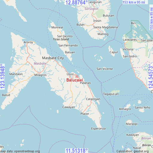
Balucawi GPS coordinates[2]
12° 12' 4.68" North, 123° 50' 33.36" East
| Map corner | latitude | longitude |
|---|---|---|
| Upper-left | 12.88764°, | 123.13948° |
| Center: | 12.2013°, | 123.8426° |
| Lower-right: | 11.51318°, | 124.54573° |
| Map W x H: | 152.8×152.8 km | = 94.9×94.9mi |
| max Lat: | 20.78733° ⇑47.3% North |
| Balucawi: | 12.2013° |
| min Lat: | ⇓52.7% South 4.65442° |
| min Long | Balucawi | max Long |
| 117.04868° | 123.8426° | 126.58417° |
| W 68.5%⇐ | ⇒31.5% E |
Elevation
Elevation of Balucawi is 24 m = 79 ft, and this is 63.9 m = 210 ft below average elevation for this country.
| Max E: |
2262 m = 7421 ft | 48.9% |
| Avg. | 87.9 m = 288 ft | |
| Balucawi | 24 m = 79 ft | |
Min E: |
-2 m = -7 ft | 51.1% |
See also: Philippines elevation on elevation.city.
Geographical zone
Balucawi is located in North Torrid zone (between Equator and Tropic of Cancer). Distance of this Northern Tropic circle is 1249.3 km =776.3 mi to North.| Distance of | km | miles | from Balucawi |
|---|---|---|---|
| North Pole | 8650.4 | 5375.1 | to North |
| Arctic Circle | 6044.5 | 3755.9 | to North |
| Tropic Cancer | 1249.3 | 776.3 | to North |
| Equator | 1356.7 | 843 | to South |


Nearby cities:
15 places around Balucawi: (largest is in red/bold)
• Armenia
12.2 km =7.6 mi,  298°
298°
• Barra
26.4 km =16.4 mi,  236°
236°
• Batuan
23.5 km =14.6 mi,  338°
338°
• Buenavista
6.3 km =3.9 mi, 243°
• Dapdap
8.5 km =5.3 mi,  280°
280°
• Dimasalang
2.1 km =1.3 mi,  119°
119°
• Marintoc
16 km =9.9 mi,  305°
305°
• Miaga
4.9 km =3 mi,  325°
325°
• Mobo
25.1 km =15.6 mi, 306°
• Nabangig
16.3 km =10.1 mi,  134°
134°
• Palanas
10.6 km =6.6 mi, 125°
• Pawican
19.8 km =12.3 mi,  135°
135°
• Peña
16.3 km =10.1 mi, 140°
• Umabay
21.4 km =13.3 mi, 304°
• Uson
7 km =4.3 mi,  292°
292°
Sources, notices
• [Note1] Compared only with cities in Philippines existing in our database
• [Src1] Map data: © OpenStreetMap contributors (CC-BY-SA)
• [Src2] Other city data from geonames.org with taken over terms of usage.
• [Src3] Geographical zone / Annual Mean Temperature by Robert A. Rohde @ Wikipedia
