Tiwi geodata
Tiwi (Bicol) is a seat of a third-order administrative division; located in Philippines in Asia/Manila (GMT+8) time zone. With population of 16,826 people, there are 407 cities with bigger population in this country. Compared to other cities in Philippines, 61.8% of cities are located further ↓South; 65.3% of cities are located further ←West and 89.7% of cities have higher elevation than Tiwi. Note1


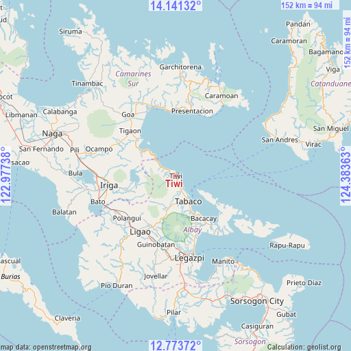
Tiwi GPS coordinates[2]
13° 27' 30.6" North, 123° 40' 49.8" East
| Map corner | latitude | longitude |
|---|---|---|
| Upper-left | 14.14132°, | 122.97738° |
| Center: | 13.4585°, | 123.6805° |
| Lower-right: | 12.77372°, | 124.38363° |
| Map W x H: | 152.1×152.1 km | = 94.5×94.5mi |
| max Lat: | 20.78733° ⇑38.2% North |
| Tiwi: | 13.4585° |
| min Lat: | ⇓61.8% South 4.65442° |
| min Long | Tiwi | max Long |
| 117.04868° | 123.6805° | 126.58417° |
| W 65.3%⇐ | ⇒34.7% E |
Elevation
Elevation of Tiwi is 7 m = 23 ft, and this is 80.9 m = 265 ft below average elevation for this country.
| Max E: |
2262 m = 7421 ft | 89.7% |
| Avg. | 87.9 m = 288 ft | |
| Tiwi | 7 m = 23 ft | |
Min E: |
-2 m = -7 ft | 10.3% |
See also: Philippines elevation on elevation.city.
Geographical zone
Tiwi is located in North Torrid zone (between Equator and Tropic of Cancer). Distance of this Northern Tropic circle is 1109.5 km =689.4 mi to North.| Distance of | km | miles | from Tiwi |
|---|---|---|---|
| North Pole | 8510.6 | 5288.2 | to North |
| Arctic Circle | 5904.7 | 3669 | to North |
| Tropic Cancer | 1109.5 | 689.4 | to North |
| Equator | 1496.4 | 929.8 | to South |


Nearby cities:
15 places around Tiwi: (largest is in red/bold)
• Bagumbayan
1.8 km =1.1 mi,  237°
237°
• Balading
8.3 km =5.2 mi,  155°
155°
• Banag
9.2 km =5.7 mi, 164°
• Baybay
6.6 km =4.1 mi,  147°
147°
• Buang
16.9 km =10.5 mi,  194°
194°
• Estancia
11.1 km =6.9 mi,  180°
180°
• Joroan
7.4 km =4.6 mi,  296°
296°
• Labnig
9.1 km =5.7 mi, 181°
• Malilipot
16.8 km =10.4 mi, 158°
• Malinao
7.2 km =4.5 mi, 156°
• Miliroc
12.8 km =8 mi,  169°
169°
• Naagas
2.5 km =1.6 mi, 185°
• Sugcad
10.4 km =6.5 mi, 168°
• Tabaco
12.5 km =7.8 mi, 152°
• Tagoytoy
4.8 km =3 mi, 183°
Sources, notices
• [Note1] Compared only with cities in Philippines existing in our database
• [Src1] Map data: © OpenStreetMap contributors (CC-BY-SA)
• [Src2] Other city data from geonames.org with taken over terms of usage.
• [Src3] Geographical zone / Annual Mean Temperature by Robert A. Rohde @ Wikipedia
