Tagoytoy geodata
Tagoytoy (Bicol) is a populated place; located in Philippines in Asia/Manila (GMT+8) time zone. With population of 2,106 people, there are 4062 cities with bigger population in this country. Compared to other cities in Philippines, 61.3% of cities are located further ↓South; 65.2% of cities are located further ←West and 62.9% of cities have lower elevation than Tagoytoy. Note1


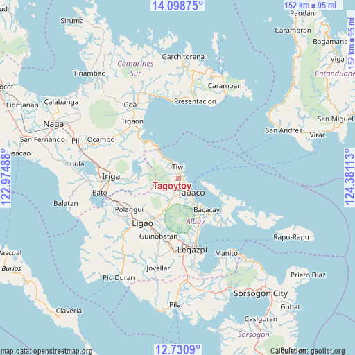
Tagoytoy GPS coordinates[2]
13° 24' 56.88" North, 123° 40' 40.8" East
| Map corner | latitude | longitude |
|---|---|---|
| Upper-left | 14.09875°, | 122.97488° |
| Center: | 13.4158°, | 123.678° |
| Lower-right: | 12.7309°, | 124.38113° |
| Map W x H: | 152.1×152.1 km | = 94.5×94.5mi |
| max Lat: | 20.78733° ⇑38.7% North |
| Tagoytoy: | 13.4158° |
| min Lat: | ⇓61.3% South 4.65442° |
| min Long | Tagoytoy | max Long |
| 117.04868° | 123.678° | 126.58417° |
| W 65.2%⇐ | ⇒34.8% E |
Elevation
Elevation of Tagoytoy is 38 m = 125 ft, and this is 49.9 m = 164 ft below average elevation for this country.
| Max E: |
2262 m = 7421 ft | 37.1% |
| Avg. | 87.9 m = 288 ft | |
| Tagoytoy | 38 m = 125 ft | |
Min E: |
-2 m = -7 ft | 62.9% |
See also: Philippines elevation on elevation.city.
Geographical zone
Tagoytoy is located in North Torrid zone (between Equator and Tropic of Cancer). Distance of this Northern Tropic circle is 1114.2 km =692.3 mi to North.| Distance of | km | miles | from Tagoytoy |
|---|---|---|---|
| North Pole | 8515.4 | 5291.2 | to North |
| Arctic Circle | 5909.5 | 3672 | to North |
| Tropic Cancer | 1114.2 | 692.3 | to North |
| Equator | 1491.7 | 926.9 | to South |


Nearby cities:
15 places around Tagoytoy: (largest is in red/bold)
• Bagumbayan
4 km =2.5 mi,  342°
342°
• Balading
4.6 km =2.9 mi,  127°
127°
• Banag
4.9 km =3 mi,  146°
146°
• Baybay
3.9 km =2.4 mi,  102°
102°
• Buang
12.2 km =7.6 mi,  198°
198°
• Estancia
6.3 km =3.9 mi,  178°
178°
• Joroan
10.3 km =6.4 mi,  321°
321°
• Labnig
4.3 km =2.7 mi, 178°
• Malilipot
12.6 km =7.8 mi, 148°
• Malinao
3.6 km =2.2 mi,  120°
120°
• Miliroc
8.3 km =5.2 mi,  161°
161°
• Naagas
2.2 km =1.4 mi,  0°
0°
• Sugcad
6 km =3.7 mi, 156°
• Tabaco
8.8 km =5.5 mi,  136°
136°
• Tiwi
4.8 km =3 mi, 3°
Sources, notices
• [Note1] Compared only with cities in Philippines existing in our database
• [Src1] Map data: © OpenStreetMap contributors (CC-BY-SA)
• [Src2] Other city data from geonames.org with taken over terms of usage.
• [Src3] Geographical zone / Annual Mean Temperature by Robert A. Rohde @ Wikipedia
