Balading geodata
Balading (Bicol) is a populated place; located in Philippines in Asia/Manila (GMT+8) time zone. With population of 2,755 people, there are 2863 cities with bigger population in this country. Compared to other cities in Philippines, 61% of cities are located further ↓South; 65.8% of cities are located further ←West and 85.4% of cities have higher elevation than Balading. Note1


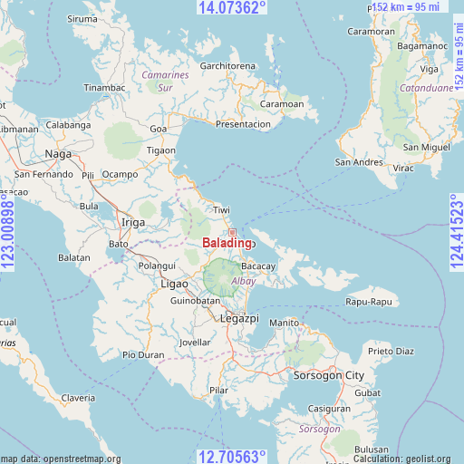
Balading GPS coordinates[2]
13° 23' 26.16" North, 123° 42' 43.56" East
| Map corner | latitude | longitude |
|---|---|---|
| Upper-left | 14.07362°, | 123.00898° |
| Center: | 13.3906°, | 123.7121° |
| Lower-right: | 12.70563°, | 124.41523° |
| Map W x H: | 152.1×152.1 km | = 94.5×94.5mi |
| max Lat: | 20.78733° ⇑39% North |
| Balading: | 13.3906° |
| min Lat: | ⇓61% South 4.65442° |
| min Long | Balading | max Long |
| 117.04868° | 123.7121° | 126.58417° |
| W 65.8%⇐ | ⇒34.2% E |
Elevation
Elevation of Balading is 8 m = 26 ft, and this is 79.9 m = 262 ft below average elevation for this country.
| Max E: |
2262 m = 7421 ft | 85.4% |
| Avg. | 87.9 m = 288 ft | |
| Balading | 8 m = 26 ft | |
Min E: |
-2 m = -7 ft | 14.6% |
See also: Philippines elevation on elevation.city.
Geographical zone
Balading is located in North Torrid zone (between Equator and Tropic of Cancer). Distance of this Northern Tropic circle is 1117 km =694.1 mi to North.| Distance of | km | miles | from Balading |
|---|---|---|---|
| North Pole | 8518.2 | 5293 | to North |
| Arctic Circle | 5912.3 | 3673.7 | to North |
| Tropic Cancer | 1117 | 694.1 | to North |
| Equator | 1488.9 | 925.2 | to South |


Nearby cities:
15 places around Balading: (largest is in red/bold)
• Bagumbayan
8.2 km =5.1 mi,  323°
323°
• Banag
1.6 km =1 mi,  216°
216°
• Baybay
2 km =1.2 mi,  4°
4°
• Buang
11.6 km =7.2 mi, 220°
• Estancia
5 km =3.1 mi, 224°
• Labnig
3.9 km =2.4 mi,  247°
247°
• Malilipot
8.5 km =5.3 mi,  160°
160°
• Malinao
1.1 km =0.7 mi,  329°
329°
• Miliroc
5.2 km =3.2 mi,  192°
192°
• Naagas
6.2 km =3.9 mi, 323°
• San Francisco
9.2 km =5.7 mi,  153°
153°
• Sugcad
3 km =1.9 mi,  206°
206°
• Tabaco
4.3 km =2.7 mi, 146°
• Tagoytoy
4.6 km =2.9 mi,  307°
307°
• Tiwi
8.3 km =5.2 mi,  335°
335°
Sources, notices
• [Note1] Compared only with cities in Philippines existing in our database
• [Src1] Map data: © OpenStreetMap contributors (CC-BY-SA)
• [Src2] Other city data from geonames.org with taken over terms of usage.
• [Src3] Geographical zone / Annual Mean Temperature by Robert A. Rohde @ Wikipedia
