Tayaman geodata
Tayaman (Mimaropa) is a populated place; located in Philippines in Asia/Manila (GMT+8) time zone. With population of 5,050 people, there are 1277 cities with bigger population in this country. Compared to other cities in Philippines, 59.1% of cities are located further ↓South; 89% of cities are located further →East and 80.7% of cities have higher elevation than Tayaman. Note1
Administrative division(s):
- Level 1: Mimaropa
- Level 2: Province of Mindoro Occidental
- Level 3: Mamburao


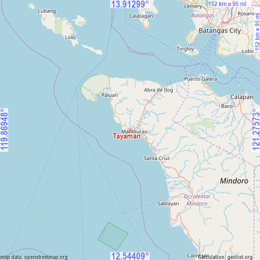
Tayaman GPS coordinates[2]
13° 13' 46.2" North, 120° 34' 21.36" East
| Map corner | latitude | longitude |
|---|---|---|
| Upper-left | 13.91299°, | 119.86948° |
| Center: | 13.2295°, | 120.5726° |
| Lower-right: | 12.54409°, | 121.27573° |
| Map W x H: | 152.2×152.2 km | = 94.6×94.6mi |
| max Lat: | 20.78733° ⇑40.9% North |
| Tayaman: | 13.2295° |
| min Lat: | ⇓59.1% South 4.65442° |
| min Long | Tayaman | max Long |
| 117.04868° | 120.5726° | 126.58417° |
| W 11%⇐ | ⇒89% E |
Elevation
Elevation of Tayaman is 9 m = 30 ft, and this is 78.9 m = 259 ft below average elevation for this country.
| Max E: |
2262 m = 7421 ft | 80.7% |
| Avg. | 87.9 m = 288 ft | |
| Tayaman | 9 m = 30 ft | |
Min E: |
-2 m = -7 ft | 19.3% |
See also: Philippines elevation on elevation.city.
Geographical zone
Tayaman is located in North Torrid zone (between Equator and Tropic of Cancer). Distance of this Northern Tropic circle is 1134.9 km =705.2 mi to North.| Distance of | km | miles | from Tayaman |
|---|---|---|---|
| North Pole | 8536.1 | 5304.1 | to North |
| Arctic Circle | 5930.2 | 3684.9 | to North |
| Tropic Cancer | 1134.9 | 705.2 | to North |
| Equator | 1471 | 914 | to South |


Nearby cities:
15 places around Tayaman: (largest is in red/bold)
• Abra de Ilog
29.2 km =18.1 mi,  35°
35°
• Balatero
48.7 km =30.3 mi,  51°
51°
• Barahan
31.7 km =19.7 mi,  139°
139°
• Cabacao
15 km =9.3 mi, 38°
• Dulangan
51.5 km =32 mi,  58°
58°
• Harrison
28.8 km =17.9 mi,  328°
328°
• Mamburao
2.6 km =1.6 mi,  105°
105°
• Odala
38.6 km =24 mi, 44°
• Paluan
23.9 km =14.9 mi, 330°
• Puerto Galera
51 km =31.7 mi, 53°
• Sablayan
48.8 km =30.3 mi,  154°
154°
• San Teodoro
52.9 km =32.9 mi, 64°
• Santa Cruz
23.8 km =14.8 mi, 136°
• Tabinay
50.5 km =31.4 mi, 55°
• Wawa
31.9 km =19.8 mi, 35°
Sources, notices
• [Note1] Compared only with cities in Philippines existing in our database
• [Src1] Map data: © OpenStreetMap contributors (CC-BY-SA)
• [Src2] Other city data from geonames.org with taken over terms of usage.
• [Src3] Geographical zone / Annual Mean Temperature by Robert A. Rohde @ Wikipedia
