Cabacao geodata
Cabacao (Mimaropa) is a populated place; located in Philippines in Asia/Manila (GMT+8) time zone. With population of 4,486 people, there are 1502 cities with bigger population in this country. Compared to other cities in Philippines, 60.5% of cities are located further ↓South; 86.1% of cities are located further →East and 51.1% of cities have lower elevation than Cabacao. Note1
Administrative division(s):
- Level 1: Mimaropa
- Level 2: Province of Mindoro Occidental
- Level 3: Abra De Ilog


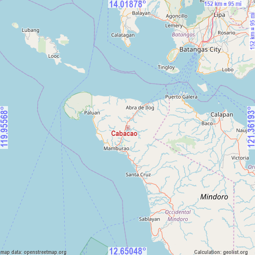
Cabacao GPS coordinates[2]
13° 20' 8.16" North, 120° 39' 31.68" East
| Map corner | latitude | longitude |
|---|---|---|
| Upper-left | 14.01878°, | 119.95568° |
| Center: | 13.3356°, | 120.6588° |
| Lower-right: | 12.65048°, | 121.36193° |
| Map W x H: | 152.1×152.1 km | = 94.5×94.5mi |
| max Lat: | 20.78733° ⇑39.5% North |
| Cabacao: | 13.3356° |
| min Lat: | ⇓60.5% South 4.65442° |
| min Long | Cabacao | max Long |
| 117.04868° | 120.6588° | 126.58417° |
| W 13.9%⇐ | ⇒86.1% E |
Elevation
Elevation of Cabacao is 24 m = 79 ft, and this is 63.9 m = 210 ft below average elevation for this country.
| Max E: |
2262 m = 7421 ft | 48.9% |
| Avg. | 87.9 m = 288 ft | |
| Cabacao | 24 m = 79 ft | |
Min E: |
-2 m = -7 ft | 51.1% |
See also: Philippines elevation on elevation.city.
Geographical zone
Cabacao is located in North Torrid zone (between Equator and Tropic of Cancer). Distance of this Northern Tropic circle is 1123.1 km =697.9 mi to North.| Distance of | km | miles | from Cabacao |
|---|---|---|---|
| North Pole | 8524.3 | 5296.8 | to North |
| Arctic Circle | 5918.4 | 3677.5 | to North |
| Tropic Cancer | 1123.1 | 697.9 | to North |
| Equator | 1482.8 | 921.4 | to South |


Nearby cities:
15 places around Cabacao: (largest is in red/bold)
• Abra de Ilog
14.2 km =8.8 mi,  32°
32°
• Balatero
34.2 km =21.3 mi,  57°
57°
• Barahan
37.7 km =23.4 mi,  162°
162°
• Dulangan
37.8 km =23.5 mi,  66°
66°
• Harrison
27.5 km =17.1 mi,  297°
297°
• Mamburao
14.2 km =8.8 mi,  208°
208°
• Odala
23.7 km =14.7 mi,  48°
48°
• Paluan
23.1 km =14.4 mi,  292°
292°
• Puerto Galera
36.7 km =22.8 mi, 59°
• Sabang
39.1 km =24.3 mi, 60°
• San Teodoro
40 km =24.9 mi, 74°
• Santa Cruz
29.9 km =18.6 mi,  166°
166°
• Tabinay
36.3 km =22.6 mi, 62°
• Tayaman
15 km =9.3 mi,  218°
218°
• Wawa
16.9 km =10.5 mi, 33°
Sources, notices
• [Note1] Compared only with cities in Philippines existing in our database
• [Src1] Map data: © OpenStreetMap contributors (CC-BY-SA)
• [Src2] Other city data from geonames.org with taken over terms of usage.
• [Src3] Geographical zone / Annual Mean Temperature by Robert A. Rohde @ Wikipedia
