Surup geodata
Surup (Davao) is a populated place; located in Philippines in Asia/Manila (GMT+8) time zone. With population of 2,119 people, there are 4046 cities with bigger population in this country. Compared to other cities in Philippines, 96.4% of cities are located further ↑North; 98.8% of cities are located further ←West and 62.2% of cities have lower elevation than Surup. Note1
Administrative division(s):
- Level 1: Davao
- Level 2: Province of Davao Oriental
- Level 3: Governor Generoso


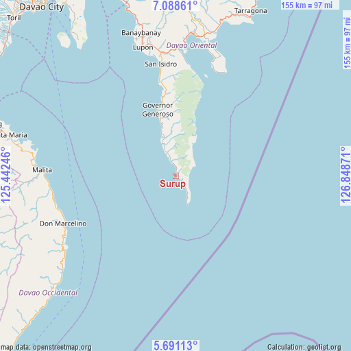
Surup GPS coordinates[2]
6° 23' 25.26" North, 126° 8' 44.088" East
| Map corner | latitude | longitude |
|---|---|---|
| Upper-left | 7.08861°, | 125.44246° |
| Center: | 6.39035°, | 126.14558° |
| Lower-right: | 5.69113°, | 126.84871° |
| Map W x H: | 155.4×155.4 km | = 96.6×96.6mi |
| max Lat: | 20.78733° ⇑96.4% North |
| Surup: | 6.39035° |
| min Lat: | ⇓3.6% South 4.65442° |
| min Long | Surup | max Long |
| 117.04868° | 126.14558° | 126.58417° |
| W 98.8%⇐ | ⇒1.2% E |
Elevation
Elevation of Surup is 37 m = 121 ft, and this is 50.9 m = 167 ft below average elevation for this country.
| Max E: |
2262 m = 7421 ft | 37.8% |
| Avg. | 87.9 m = 288 ft | |
| Surup | 37 m = 121 ft | |
Min E: |
-2 m = -7 ft | 62.2% |
See also: Philippines elevation on elevation.city.
Geographical zone
Surup is located in North Torrid zone (between Equator and Tropic of Cancer). Distance of Equator is 710.5 km =441.5 mi to South.| Distance of | km | miles | from Surup |
|---|---|---|---|
| North Pole | 9296.5 | 5776.6 | to North |
| Arctic Circle | 6690.6 | 4157.3 | to North |
| Tropic Cancer | 1895.4 | 1177.7 | to North |
| Equator | 710.5 | 441.5 | to South |


Nearby cities:
15 places around Surup: (largest is in red/bold)
• Baon
45.5 km =28.3 mi,  351°
351°
• Batobato
48.8 km =30.3 mi, 352°
• Bitaogan
42.7 km =26.5 mi, 349°
• La Union
35.5 km =22.1 mi, 349°
• Luzon
15.4 km =9.6 mi,  338°
338°
• Magdug
18.4 km =11.4 mi, 342°
• Manikling
55.1 km =34.2 mi, 350°
• Nangan
9.4 km =5.8 mi, 345°
• Pondaguitan
4.8 km =3 mi,  132°
132°
• Sigaboy
30.4 km =18.9 mi, 344°
• Talagutong
54.6 km =33.9 mi,  255°
255°
• Talisay
37 km =23 mi, 352°
• Tamisan
53.2 km =33.1 mi,  18°
18°
• Tibanbang
27.2 km =16.9 mi, 350°
• Tiblawan
10.6 km =6.6 mi, 337°
Sources, notices
• [Note1] Compared only with cities in Philippines existing in our database
• [Src1] Map data: © OpenStreetMap contributors (CC-BY-SA)
• [Src2] Other city data from geonames.org with taken over terms of usage.
• [Src3] Geographical zone / Annual Mean Temperature by Robert A. Rohde @ Wikipedia
