Magdug geodata
Magdug (Davao) is a populated place; located in Philippines in Asia/Manila (GMT+8) time zone. With population of 2,343 people, there are 3576 cities with bigger population in this country. Compared to other cities in Philippines, 95.3% of cities are located further ↑North; 98.6% of cities are located further ←West and 59.2% of cities have higher elevation than Magdug. Note1
Administrative division(s):
- Level 1: Davao
- Level 2: Province of Davao Oriental
- Level 3: Governor Generoso


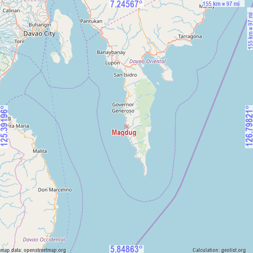
Magdug GPS coordinates[2]
6° 32' 51.504" North, 126° 5' 42.288" East
| Map corner | latitude | longitude |
|---|---|---|
| Upper-left | 7.24567°, | 125.39196° |
| Center: | 6.54764°, | 126.09508° |
| Lower-right: | 5.84863°, | 126.79821° |
| Map W x H: | 155.3×155.3 km | = 96.5×96.5mi |
| max Lat: | 20.78733° ⇑95.3% North |
| Magdug: | 6.54764° |
| min Lat: | ⇓4.7% South 4.65442° |
| min Long | Magdug | max Long |
| 117.04868° | 126.09508° | 126.58417° |
| W 98.6%⇐ | ⇒1.4% E |
Elevation
Elevation of Magdug is 17 m = 56 ft, and this is 70.9 m = 233 ft below average elevation for this country.
| Max E: |
2262 m = 7421 ft | 59.2% |
| Avg. | 87.9 m = 288 ft | |
| Magdug | 17 m = 56 ft | |
Min E: |
-2 m = -7 ft | 40.8% |
See also: Philippines elevation on elevation.city.
Geographical zone
Magdug is located in North Torrid zone (between Equator and Tropic of Cancer). Distance of Equator is 728 km =452.4 mi to South.| Distance of | km | miles | from Magdug |
|---|---|---|---|
| North Pole | 9279 | 5765.7 | to North |
| Arctic Circle | 6673.1 | 4146.5 | to North |
| Tropic Cancer | 1877.9 | 1166.9 | to North |
| Equator | 728 | 452.4 | to South |


Nearby cities:
15 places around Magdug: (largest is in red/bold)
• Baon
27.6 km =17.1 mi,  358°
358°
• Batobato
30.9 km =19.2 mi, 357°
• Bitaogan
24.6 km =15.3 mi, 355°
• La Union
17.4 km =10.8 mi, 357°
• Lupon
40.1 km =24.9 mi,  346°
346°
• Luzon
3.2 km =2 mi,  181°
181°
• Manikling
37 km =23 mi, 354°
• Nangan
8.9 km =5.5 mi,  158°
158°
• Pondaguitan
22.7 km =14.1 mi, 156°
• Sigaboy
12.1 km =7.5 mi, 348°
• Surup
18.4 km =11.4 mi, 162°
• Talisay
19.1 km =11.9 mi,  1°
1°
• Tamisan
39.8 km =24.7 mi,  34°
34°
• Tibanbang
9.4 km =5.8 mi,  7°
7°
• Tiblawan
7.8 km =4.8 mi,  169°
169°
Sources, notices
• [Note1] Compared only with cities in Philippines existing in our database
• [Src1] Map data: © OpenStreetMap contributors (CC-BY-SA)
• [Src2] Other city data from geonames.org with taken over terms of usage.
• [Src3] Geographical zone / Annual Mean Temperature by Robert A. Rohde @ Wikipedia
